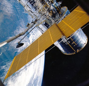
GEO Satellites: The Backbone of Global Telecommunications – Understanding GEO Satellites

GEO Satellites: The Backbone of Global Telecommunications – Understanding GEO Satellites
GEO satellites, or Geostationary Earth Orbit satellites, have been the backbone of global telecommunications for decades. These satellites, orbiting the Earth at an altitude of approximately 36,000 kilometers, play a crucial role in providing connectivity and enabling international communications. At the heart of modern telecommunications, GEO satellites have revolutionized the way we communicate, facilitating global communication networks and providing essential services to millions of people around the world.
Since the launch of the first GEO satellite, Syncom 2, in 1963, the technology has undergone significant advancements. Today, GEO satellites are used for a wide range of applications, including telecommunications, broadcasting, weather forecasting, and navigation. Their ability to provide high-gain antennas, allowing for strong signal transmission and reception, makes them ideal for applications requiring high-bandwidth connectivity.
A Brief History of GEO Satellites
The concept of GEO satellites dates back to the 1940s, when science fiction writer Arthur C. Clarke proposed the idea of using satellites in geostationary orbit for communications. The first GEO satellite, Syncom 2, was launched by NASA in 1963, followed by Syncom 3, which was used to broadcast the 1964 Summer Olympics in Tokyo. Since then, the number of GEO satellites in orbit has grown significantly, with thousands of satellites launched over the years.
GEO satellites have also played a significant role in the development of modern telecommunications. The first commercial GEO satellite, Intelsat 1, was launched in 1965, providing transatlantic telecommunications services. Today, GEO satellites are used by numerous organizations, including telecommunications companies, governments, and international organizations, to provide a wide range of services, including voice and data communications, internet connectivity, and broadcasting.
How GEO Satellites Work
GEO satellites work by orbiting the Earth at an altitude of approximately 36,000 kilometers, which allows them to maintain a fixed position in the sky relative to a point on the Earth’s surface. This fixed position enables the satellite to provide continuous coverage to a specific region, making it ideal for applications requiring high-bandwidth connectivity.
The process of communicating through a GEO satellite involves several steps. First, a signal is transmitted from a ground station to the satellite, where it is received and amplified by the satellite’s onboard transponder. The signal is then re-transmitted back to Earth, where it is received by another ground station or directly by the end-user. This process allows for high-speed data transmission and reception, making it possible to provide a wide range of services, including voice and data communications, internet connectivity, and broadcasting.
Significance of GEO Satellites in Modern Telecommunications
GEO satellites play a vital role in modern telecommunications, providing connectivity and enabling international communications. They offer several advantages, including global coverage, high-bandwidth connectivity, and reliability. GEO satellites are also used to provide essential services, such as emergency communications, weather forecasting, and navigation.
In addition to their technical advantages, GEO satellites also offer several economic benefits. They provide a cost-effective means of establishing global communications networks, reducing the need for costly infrastructure development. Furthermore, GEO satellites enable the provision of services to remote and underserved areas, promoting economic development and social inclusion.
Despite the advent of new technologies, such as fiber optic cables and terrestrial networks, GEO satellites remain a crucial component of modern telecommunications. Their ability to provide global coverage, high-bandwidth connectivity, and reliability makes them an essential tool for a wide range of applications, from telecommunications and broadcasting to weather forecasting and navigation.


