GEO Satellites: Unlocking the Power of Geostationary Orbit
GEO Satellites: Unlocking the Power of Geostationary Orbit
GEO satellites, or Geostationary satellites, are a type of satellite that orbits the Earth at an altitude of approximately 36,000 kilometers, remaining stationary relative to a fixed point on the equator. This unique characteristic allows GEO satellites to provide continuous coverage of a specific region, making them ideal for a variety of applications, including telecommunications, weather forecasting, and navigation.
The concept of GEO satellites was first proposed by science fiction writer Arthur C. Clarke in 1945, and the first GEO satellite, Syncom 2, was launched in 1963. Since then, the technology has evolved significantly, with modern GEO satellites offering high-speed data transmission, advanced navigation systems, and improved imaging capabilities.
How GEO Satellites Work
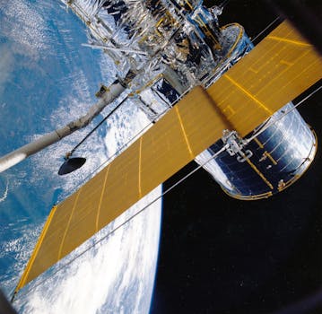
GEO satellites operate by transmitting and receiving signals to and from Earth stations, which are typically located on the ground. The signals are transmitted through a network of antennas and transponders, which amplify and re-transmit the signals back to Earth. GEO satellites are equipped with a range of instruments, including transponders, antennas, and solar panels, which provide power and enable communication with Earth stations.
The geostationary orbit of GEO satellites allows them to maintain a fixed position relative to a specific point on the Earth’s surface, providing continuous coverage of a particular region. This is achieved through a combination of the satellite’s velocity and the Earth’s rotation, which ensures that the satellite remains stationary relative to a fixed point on the equator.
Applications of GEO Satellites
GEO satellites have a wide range of applications, including telecommunications, weather forecasting, navigation, and Earth observation. In telecommunications, GEO satellites are used to provide broadband internet, television broadcasting, and mobile phone services to remote and underserved areas. They are also used for weather forecasting, providing high-resolution images of the Earth’s atmosphere and oceans, which help meteorologists predict weather patterns and track natural disasters.
In navigation, GEO satellites are used to provide location information and timing signals, which are used in GPS systems to determine precise locations and velocities. They are also used in Earth observation, providing high-resolution images of the Earth’s surface, which are used to monitor environmental changes, track natural disasters, and manage natural resources.
Benefits and Challenges of GEO Satellites
The use of GEO satellites offers a number of benefits, including global coverage, high-speed data transmission, and continuous availability. They are also relatively low-cost compared to other types of satellites, and can be launched using a variety of launch vehicles. However, GEO satellites also pose some challenges, including signal latency, interference from other satellites, and the risk of collision with space debris.
Despite these challenges, GEO satellites remain a crucial part of modern satellite communication, offering a wide range of benefits and applications. As technology continues to evolve, we can expect to see even more advanced GEO satellites, with improved capabilities and applications.


