GEO satellites, or geostationary orbit satellites, are a type of satellite that operates in a geostationary orbit around the Earth. This means that they remain stationary in the sky, relative to a fixed point on the Earth’s surface, and are used for a variety of applications including telecommunications, navigation, and weather forecasting. In this article, we will explore the technology and applications of GEO satellites, and examine their importance in modern society.
GEO satellites are placed in a geostationary orbit, which is approximately 36,000 kilometers above the equator. At this altitude, the satellite’s orbital period matches the Earth’s rotational period, allowing it to remain stationary in the sky. This unique characteristic makes GEO satellites ideal for applications that require a fixed point of reference, such as telecommunications and navigation.
One of the primary applications of GEO satellites is in telecommunications. They are used to transmit data, voice, and video signals across the globe, providing connectivity to remote and underserved areas. GEO satellites are also used for broadcasting, allowing television channels to reach a global audience. In addition, they are used for navigation, providing location information and timing signals for GPS and other navigation systems.
GEO satellites are also used for weather forecasting and climate monitoring. They are equipped with specialized instruments that can detect changes in the Earth’s atmosphere, oceans, and land surfaces, allowing scientists to track weather patterns and predict future weather events. This information is crucial for predicting natural disasters, such as hurricanes and droughts, and for understanding the impacts of climate change.
How GEO Satellites Work
GEO satellites are complex systems that require precise engineering and operation. They are typically launched into space using a rocket, and then propelled into a geostationary orbit using a combination of propulsion systems. Once in orbit, the satellite’s systems are activated, and it begins to transmit and receive data.
The satellite’s payload is made up of a variety of instruments, including transponders, antennas, and sensors. The transponders are used to amplify and re-transmit signals, while the antennas are used to receive and transmit data. The sensors are used to collect data on the Earth’s atmosphere, oceans, and land surfaces.
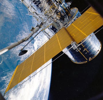
GEO satellites are powered by solar panels, which convert sunlight into electrical energy. The energy is then stored in batteries, which power the satellite’s systems during periods of darkness. The satellite’s systems are controlled by a sophisticated computer system, which monitors the satellite’s performance and makes adjustments as necessary.
The satellite’s communication system is designed to transmit and receive data in a variety of frequencies, including C-band, Ku-band, and Ka-band. The data is transmitted through a network of ground stations, which receive and process the data for distribution to users.
Applications of GEO Satellites
GEO satellites have a wide range of applications, including telecommunications, navigation, weather forecasting, and climate monitoring. They are also used for scientific research, such as studying the Earth’s magnetic field and the upper atmosphere.
In telecommunications, GEO satellites are used to provide connectivity to remote and underserved areas. They are also used for broadcasting, allowing television channels to reach a global audience. In addition, they are used for navigation, providing location information and timing signals for GPS and other navigation systems.
In weather forecasting and climate monitoring, GEO satellites are used to track weather patterns and predict future weather events. They are equipped with specialized instruments that can detect changes in the Earth’s atmosphere, oceans, and land surfaces, allowing scientists to track weather patterns and predict future weather events.
GEO satellites are also used for disaster response and recovery. They are used to provide critical communication services during natural disasters, such as hurricanes and earthquakes. They are also used to assess damage and provide situational awareness during disaster response and recovery efforts.
Future of GEO Satellites
The future of GEO satellites is promising, with advancements in technology and increasing demand for satellite-based services. Next-generation GEO satellites will have improved capabilities, such as higher bandwidth and more advanced sensors.
One of the trends in the GEO satellite industry is the development of high-throughput satellites (HTS). HTS satellites are designed to provide higher bandwidth and faster data speeds, making them ideal for applications such as broadband internet and video streaming.
Another trend is the use of electric propulsion systems, which are more efficient and provide longer mission durations. Electric propulsion systems use electrical energy to propel the satellite, rather than traditional chemical propulsion systems.
The GEO satellite industry is also experiencing a shift towards more commercialized and privatized operations. Companies such as SpaceX and OneWeb are launching constellations of satellites to provide global internet coverage and other services.