GEO Satellites: Unlocking the Potential of Geostationary Orbit
GEO Satellites: Unlocking the Potential of Geostationary Orbit
GEO satellites, or Geostationary satellites, are a type of satellite that orbits the Earth at an altitude of approximately 36,000 kilometers, remaining stationary relative to a fixed point on the Earth’s surface. This unique characteristic allows GEO satellites to provide continuous coverage of a specific region, making them ideal for a variety of applications, including telecommunications, weather forecasting, and navigation.
History of GEO Satellites
The concept of GEO satellites was first proposed by science fiction writer Arthur C. Clarke in 1945. However, it wasn’t until the 1960s that the first GEO satellite, Syncom 2, was launched. Since then, thousands of GEO satellites have been launched, with many more planned for the future. The development of GEO satellites has been driven by advances in technology, including improvements in rocketry, materials science, and electronic engineering.
Technology and Applications
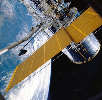
GEO satellites use a combination of solar panels and batteries to generate power, and are equipped with advanced communication equipment, including transponders, antennas, and receivers. They are used for a wide range of applications, including television broadcasting, telecommunications, internet connectivity, and weather forecasting. GEO satellites are also used for navigation, providing location information and timing signals for GPS and other navigation systems.
Future Developments
As technology continues to advance, we can expect to see significant developments in the field of GEO satellites. One area of research is the development of new propulsion systems, which could enable GEO satellites to change orbit and maneuver more efficiently. Another area of research is the development of advanced materials and technologies, such as nano-satellites and quantum communications. These advances could enable the creation of smaller, more efficient, and more powerful GEO satellites, with a wider range of applications and capabilities.
GEO satellites are also being used for a variety of scientific research applications, including Earth observation, space weather monitoring, and astronomy. They provide a unique platform for studying the Earth’s climate, oceans, and land surfaces, and are used to monitor natural disasters such as hurricanes, wildfires, and earthquakes.
In addition to their practical applications, GEO satellites also play a critical role in the development of modern society. They enable global communication and connectivity, facilitate international trade and commerce, and provide critical infrastructure for emergency response and disaster relief. As the world becomes increasingly dependent on satellite communications, the importance of GEO satellites will only continue to grow.
However, the use of GEO satellites also raises important questions about sustainability and environmental impact. The increasing number of satellites in orbit around the Earth poses a significant risk of collisions and space debris, which could have catastrophic consequences for the satellite industry and the environment. To address these concerns, researchers and policymakers are working to develop new technologies and regulations for sustainable satellite operations, including the use of reusable rockets, de-orbiting systems, and international cooperation on space traffic management.
In conclusion, GEO satellites are a vital part of modern satellite communications, offering a wide range of benefits and applications. From their early development to their current status as a critical component of global infrastructure, GEO satellites have played a significant role in shaping the modern world. As technology continues to advance, we can expect to see significant developments in the field of GEO satellites, with new applications, capabilities, and opportunities emerging in the years to come.


