GEO Satellites: Understanding the Technology and Applications of Geostationary Orbit Satellites
GEO Satellites: Understanding the Technology and Applications of Geostationary Orbit Satellites
GEO satellites, or geostationary orbit satellites, are a type of satellite that orbits the Earth at an altitude of approximately 36,000 kilometers, which is about 35,786 kilometers above the equator. At this altitude, the satellite’s orbital period matches the Earth’s rotational period, allowing it to remain stationary in the sky relative to a fixed point on the Earth’s surface. This unique characteristic of GEO satellites makes them ideal for a variety of applications, including telecommunications, navigation, and weather forecasting.
Geostationary orbit satellites have been in use for several decades, with the first GEO satellite, Syncom 2, launched in 1963. Since then, numerous GEO satellites have been launched, providing a wide range of services, including television broadcasting, telecommunications, navigation, and weather forecasting. The use of GEO satellites has become an integral part of modern life, enabling global communication, navigation, and weather forecasting.
How GEO Satellites Work
GEO satellites work by transmitting and receiving signals to and from Earth stations, which are located on the ground. The satellites are equipped with transponders, which are devices that receive signals from Earth stations, amplify them, and then re-transmit them back to other Earth stations. This allows for communication between different parts of the world, enabling global communication and navigation.
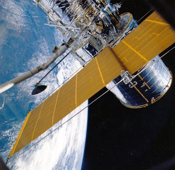
The satellites are also equipped with antennas, which are used to receive and transmit signals. The antennas are designed to provide a high gain, which allows the satellite to communicate with Earth stations that are located thousands of kilometers away. The satellites also have solar panels, which provide the power needed to operate the satellite’s systems.
Applications of GEO Satellites
GEO satellites have a wide range of applications, including telecommunications, navigation, and weather forecasting. In the telecommunications sector, GEO satellites are used to provide television broadcasting, internet connectivity, and mobile phone services. They are also used for navigation, providing location information and timing signals for GPS and other navigation systems.
In the weather forecasting sector, GEO satellites are used to monitor the weather and provide images of cloud patterns, sea surface temperatures, and other weather-related data. This information is used to predict weather patterns and provide early warnings for severe weather events. GEO satellites are also used for search and rescue operations, providing location information for emergency responders.
Advantages and Disadvantages of GEO Satellites
GEO satellites have several advantages, including their ability to provide global coverage, high bandwidth, and reliability. They are also relatively low maintenance, as they do not require frequent adjustments to their orbits. However, GEO satellites also have some disadvantages, including their high cost, limited flexibility, and vulnerability to interference from other satellites.
Despite these disadvantages, GEO satellites remain a crucial part of modern telecommunications, navigation, and weather forecasting systems. Their ability to provide global coverage and high bandwidth makes them an essential tool for a wide range of applications, from television broadcasting to search and rescue operations.
Future of GEO Satellites
The future of GEO satellites is expected to be shaped by advances in technology and changes in the satellite industry. One of the key trends in the satellite industry is the increasing use of high-throughput satellites (HTS), which provide higher bandwidth and faster data speeds. HTS satellites are expected to play a major role in the development of 5G networks, providing the high-speed data connectivity needed for 5G services.
Another trend in the satellite industry is the increasing use of small satellites, which are smaller and less expensive than traditional satellites. Small satellites are expected to play a major role in the development of constellations, which are networks of satellites that work together to provide global coverage. Constellations are expected to provide a range of services, including telecommunications, navigation, and Earth observation.


