
GEO Satellites: Unlocking the Power of Geostationary Orbit
GEO satellites, or Geostationary satellites, are a type of satellite that orbits the Earth at an altitude of approximately 36,000 kilometers, remaining stationary relative to a fixed point on the planet. This unique characteristic allows GEO satellites to provide continuous coverage of a specific region, making them ideal for a wide range of applications, including telecommunications, weather forecasting, and navigation.
The concept of GEO satellites was first proposed by scientist Arthur C. Clarke in 1945, and the first GEO satellite, Syncom 2, was launched in 1963. Since then, hundreds of GEO satellites have been launched, revolutionizing the way we communicate, navigate, and understand our planet.
How GEO Satellites Work
GEO satellites work by using a combination of propulsion systems and gravity to maintain their stationary position in orbit. They are typically launched into a geostationary transfer orbit (GTO) and then use their onboard propulsion systems to circularize their orbit and reach their final destination. Once in position, GEO satellites use their station-keeping thrusters to maintain their precise location and altitude, ensuring continuous coverage of their designated region.
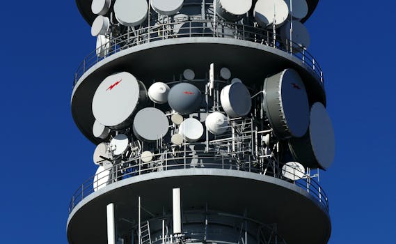
The signals transmitted by GEO satellites are received by Earth stations, which are specialized antennas designed to communicate with the satellite. These signals are then re-transmitted to other locations, allowing for global communication and connectivity. GEO satellites can also be used for broadcasting, providing television and radio services to millions of people around the world.
Applications of GEO Satellites
GEO satellites have a wide range of applications, including telecommunications, weather forecasting, navigation, and Earth observation. They are used by governments, corporations, and individuals to provide critical services such as mobile phone networks, internet connectivity, and television broadcasting.
In addition to their commercial applications, GEO satellites also play a critical role in scientific research and exploration. They are used to study the Earth’s climate, monitor natural disasters, and provide early warnings for severe weather events. GEO satellites are also used in search and rescue operations, helping to locate missing people and provide critical assistance in emergency situations.
Future of GEO Satellites
The future of GEO satellites is exciting and rapidly evolving. With advancements in technology, new applications and services are being developed, such as high-throughput satellites (HTS) and very high-throughput satellites (VHTS). These next-generation satellites will provide even faster and more reliable connectivity, enabling new uses such as 5G networks and IoT (Internet of Things) applications.
In conclusion, GEO satellites are a vital part of modern satellite technology, providing unparalleled connectivity and communication services. Their unique characteristics and wide range of applications make them an essential tool for governments, corporations, and individuals around the world. As technology continues to advance, we can expect to see even more innovative applications and services from GEO satellites in the future.