MEO Satellites: Revolutionizing Global Connectivity with Medium Earth Orbit Technology
MEO Satellites: Revolutionizing Global Connectivity with Medium Earth Orbit Technology
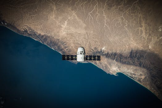
MEO satellites, or Medium Earth Orbit satellites, are a type of satellite that operates in an orbit between 2,000 and 36,000 kilometers above the Earth’s surface. This orbit is lower than geostationary orbit, which is approximately 36,000 kilometers above the equator, but higher than low Earth orbit, which is typically around 1,000 kilometers above the Earth. The unique characteristics of MEO satellites make them ideal for a wide range of applications, including telecommunications, navigation, and Earth observation.
How MEO Satellites Work
MEO satellites take advantage of their medium altitude to provide a number of benefits over other types of satellites. Because they are closer to the Earth than geostationary satellites, MEO satellites have a lower latency, which means that signals transmitted to and from the satellite have a shorter distance to travel. This results in faster communication and data transfer rates. Additionally, MEO satellites have a wider field of view than low Earth orbit satellites, allowing them to cover larger areas of the Earth’s surface.
MEO satellites are often used in constellations, which are groups of satellites working together to provide continuous coverage of the Earth. These constellations can be used to provide a range of services, including broadband internet, mobile phone networks, and navigation systems. One of the most well-known examples of a MEO satellite constellation is the O3b Networks system, which provides high-speed internet connectivity to remote and underserved communities around the world.
Applications of MEO Satellites
MEO satellites have a wide range of applications, including telecommunications, navigation, Earth observation, and scientific research. In the field of telecommunications, MEO satellites are used to provide broadband internet, mobile phone networks, and other communication services. They are particularly useful for providing connectivity to remote and underserved communities, where traditional terrestrial infrastructure may not be available.
In the field of navigation, MEO satellites are used to provide location information and timing signals. The most well-known example of a navigation system that uses MEO satellites is the Global Positioning System (GPS), which is operated by the United States Department of Defense. Other navigation systems that use MEO satellites include the Russian GLONASS system and the European Galileo system.
MEO satellites are also used for Earth observation, where they can provide high-resolution images of the Earth’s surface. These images can be used for a wide range of applications, including environmental monitoring, agricultural management, and disaster response. Scientific research is another area where MEO satellites are used, as they can provide a unique perspective on the Earth’s atmosphere, oceans, and land surfaces.
Benefits and Challenges of MEO Satellites
MEO satellites offer a number of benefits over other types of satellites, including lower latency, wider field of view, and higher resolution imagery. However, they also present a number of challenges, including higher launch costs, more complex orbital dynamics, and increased risk of interference from other satellites. Despite these challenges, MEO satellites are becoming increasingly popular, as they offer a unique combination of performance, coverage, and cost-effectiveness.
In conclusion, MEO satellites are revolutionizing global connectivity by providing faster, more reliable, and more cost-effective communication and data transfer services. With their unique combination of low latency, wide field of view, and high resolution imagery, MEO satellites are ideal for a wide range of applications, including telecommunications, navigation, Earth observation, and scientific research. As the demand for global connectivity continues to grow, it is likely that MEO satellites will play an increasingly important role in meeting this demand.