GEO Satellites: Introduction and History
GEO satellites, or Geostationary Earth Orbit satellites, are a type of satellite that orbits the Earth at an altitude of approximately 36,000 kilometers, remaining stationary relative to a fixed point on the equator. The concept of GEO satellites was first proposed by scientist Arthur C. Clarke in 1945, and the first GEO satellite, Syncom 2, was launched in 1963. Since then, GEO satellites have become a cornerstone of modern telecommunications, providing global coverage and enabling a wide range of applications, including television broadcasting, telecommunications, and weather forecasting.
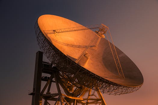
GEO Satellite Technology and Design
GEO satellites are designed to operate in the geostationary orbit, which is a unique orbit that allows the satellite to remain stationary relative to a fixed point on the equator. This is achieved by launching the satellite into an orbit that has a period of 24 hours, matching the Earth’s rotational period. GEO satellites are typically equipped with a range of instruments and antennas, including transponders, which are used to receive and retransmit signals. The satellites are also equipped with solar panels and batteries, which provide power, and propulsion systems, which are used to maintain the satellite’s position and altitude.
Applications of GEO Satellites
GEO satellites have a wide range of applications, including television broadcasting, telecommunications, and weather forecasting. They are used to provide global coverage, enabling signals to be transmitted and received from anywhere in the world. GEO satellites are also used for navigation, providing location information and timing signals for GPS and other navigation systems. In addition, GEO satellites are used for scientific research, including Earth observation, climate monitoring, and space weather forecasting.
Telecommunications and Television Broadcasting
GEO satellites play a critical role in modern telecommunications, providing global coverage and enabling the transmission of signals over long distances. They are used for a range of applications, including telephone communications, internet connectivity, and television broadcasting. GEO satellites are used to transmit television signals, enabling global coverage and providing access to a wide range of channels and programming.
Weather Forecasting and Earth Observation
GEO satellites are used for weather forecasting and Earth observation, providing critical data and imagery for meteorologists and scientists. They are equipped with a range of instruments, including cameras, spectrometers, and radar systems, which are used to collect data on the Earth’s atmosphere, oceans, and land surfaces. This data is used to predict weather patterns, monitor climate change, and track natural disasters.