GEO Satellites: Revolutionizing Global Communication and Navigation
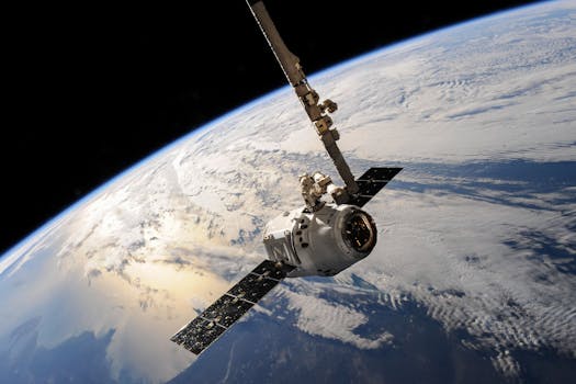
GEO satellites, or Geostationary Orbit satellites, have been a cornerstone of modern technology for decades, providing essential services such as telecommunications, weather forecasting, and navigation. At the beginning of our discussion on GEO satellites, it’s crucial to understand the significance of these satellites in our daily lives. With the ability to remain stationary over a specific point on the Earth’s equator, GEO satellites have enabled global communication, navigation, and weather forecasting, transforming the way we live, work, and interact with one another.
One of the primary functions of GEO satellites is to provide telecommunications services, including television broadcasting, internet connectivity, and mobile phone networks. By transmitting signals to and from Earth, GEO satellites enable global communication, connecting people and businesses across the globe. For instance, GEO satellites are used to broadcast television channels, providing entertainment and news to millions of people worldwide. Additionally, GEO satellites are used to provide internet connectivity to remote and underserved areas, bridging the digital divide and promoting economic development.
GEO Satellites and Navigation
GEO satellites also play a critical role in navigation, providing location information and timing signals to GPS receivers on the ground. This enables precise navigation and tracking, which is essential for various industries such as aviation, maritime, and transportation. Furthermore, GEO satellites are used to provide emergency position-indicating radio beacons (EPIRBs), which help to locate and rescue people in distress. The use of GEO satellites in navigation has revolutionized the way we travel, making it safer and more efficient.
In addition to telecommunications and navigation, GEO satellites are also used for weather forecasting and climate monitoring. By orbiting the Earth at an altitude of approximately 36,000 kilometers, GEO satellites can provide high-resolution images of the Earth’s surface and atmosphere, enabling meteorologists to track weather patterns and predict storms. This information is crucial for protecting life and property, as well as for planning and decision-making in various industries such as agriculture, aviation, and emergency management.
The Future of GEO Satellites
As technology continues to evolve, the role of GEO satellites is expected to expand and diversify. Next-generation GEO satellites will offer higher bandwidth, faster data transfer rates, and improved signal quality, enabling new services such as high-definition television broadcasting, ultra-high-speed internet connectivity, and advanced navigation systems. Additionally, the development of new satellite constellations, such as the OneWeb and Amazon Kuiper Systems, will provide global coverage and connectivity, bridging the digital divide and promoting economic growth.
In conclusion, GEO satellites have revolutionized global communication and navigation, providing essential services that have transformed the way we live, work, and interact with one another. As technology continues to evolve, the role of GEO satellites will expand and diversify, enabling new services and applications that will shape the future of our planet.
Challenges and Limitations of GEO Satellites
Despite the many benefits of GEO satellites, there are also challenges and limitations associated with their use. One of the primary challenges is the risk of satellite congestion, which occurs when too many satellites are launched into the same orbit, causing interference and signal degradation. This can lead to reduced performance, increased errors, and even complete loss of service. Furthermore, the increasing amount of space debris in the geostationary orbit poses a significant threat to the long-term sustainability of GEO satellites, as collisions between satellites and debris can cause damage or complete loss of the satellite.
To address these challenges, it is essential to develop and implement sustainable practices for the use of GEO satellites, such as responsible satellite operations, collision avoidance, and debris removal. Additionally, regulatory frameworks and international cooperation are necessary to ensure the long-term sustainability of the geostationary orbit and the continued provision of essential services by GEO satellites.
