Eyes in the Sky: Advanced Technologies Transforming Earth Observation
Eyes in the Sky: Advanced Technologies Transforming Earth Observation, the ability to observe and monitor our planet from space has revolutionized various fields, including environmental monitoring, natural resource management, and disaster response. The rapid advancement of technologies such as satellite imaging, remote sensing, and geographic information systems (GIS) has enabled us to collect and analyze vast amounts of data about our planet, providing valuable insights into its dynamics and changes.
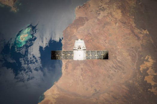
The use of satellite technology for earth observation has become increasingly important in recent years, with many governments and organizations investing heavily in satellite programs. Satellites in orbit around the Earth provide a unique perspective on our planet, allowing us to monitor changes in the environment, track weather patterns, and detect natural disasters such as earthquakes, hurricanes, and tsunamis. The data collected by satellites is used in a variety of applications, including climate modeling, agricultural monitoring, and urban planning.
Advances in Satellite Technology
One of the key drivers of the transformation of earth observation is the rapid advancement of satellite technology. Modern satellites are equipped with sophisticated sensors and imaging systems that can collect high-resolution data about the Earth’s surface and atmosphere. The resolution of satellite images has increased significantly in recent years, allowing us to observe features on the Earth’s surface that were previously invisible. For example, the European Space Agency’s (ESA) Sentinel-2 satellite can collect images with a resolution of up to 10 meters, while the NASA’s Landsat 8 satellite can collect images with a resolution of up to 15 meters.
In addition to improvements in image resolution, satellite technology has also become more affordable and accessible. The cost of launching and operating satellites has decreased significantly in recent years, making it possible for more organizations and countries to participate in earth observation. The development of small satellite technology, such as CubeSats, has also made it possible for universities, research institutions, and private companies to launch their own satellites and collect data about the Earth.
Applications of Earth Observation
The applications of earth observation are diverse and numerous. One of the most significant applications is environmental monitoring. Satellites can be used to monitor changes in the environment, such as deforestation, ocean pollution, and climate change. For example, the NASA’s Terra satellite is used to monitor the health of the world’s forests, while the ESA’s Envisat satellite is used to monitor ocean currents and sea level rise.
Earth observation is also used in natural resource management. Satellites can be used to monitor the extent and health of crops, allowing farmers to optimize their irrigation and fertilization strategies. Satellites can also be used to monitor the location and extent of mineral deposits, allowing mining companies to optimize their extraction strategies.
Conclusion
In conclusion, the transformation of earth observation through advanced technologies has enabled us to monitor and understand our planet like never before. The rapid advancement of satellite technology, remote sensing, and GIS has provided us with valuable insights into the dynamics and changes of our planet. The applications of earth observation are diverse and numerous, ranging from environmental monitoring to natural resource management. As technology continues to evolve, we can expect to see even more innovative applications of earth observation in the future.


