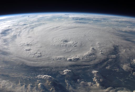
The Role of Satellites in Global Weather Forecasting Systems
The role of satellites in global weather forecasting systems is a crucial one, as they provide vital data and images that help meteorologists predict weather patterns and storms. Satellites have been used for weather forecasting for decades, and their importance has only grown as technology has improved. In this article, we will explore the role of satellites in global weather forecasting systems, including the different types of satellites used, the data they provide, and the impact they have on our understanding of the weather.
Satellites have revolutionized the field of weather forecasting, allowing meteorologists to predict weather patterns and storms with greater accuracy than ever before. The first weather satellite, TIROS-1, was launched in 1960, and since then, numerous satellites have been launched to provide data and images of the weather. Today, there are many different types of satellites used for weather forecasting, including geostationary satellites, polar-orbiting satellites, and constellations of small satellites.
Types of Satellites Used for Weather Forecasting
Geostationary satellites are located in a fixed position above the equator, at an altitude of approximately 36,000 kilometers. These satellites provide continuous coverage of a specific region, allowing meteorologists to monitor weather patterns and storms in real-time. Geostationary satellites are equipped with cameras and sensors that capture images of the weather, including visible light, infrared, and water vapor imagery. The data from these satellites is used to predict weather patterns, including cloud formation, precipitation, and wind direction.
Polar-orbiting satellites, on the other hand, orbit the Earth at a much lower altitude, typically around 800 kilometers. These satellites provide global coverage, allowing meteorologists to monitor weather patterns and storms across the entire planet. Polar-orbiting satellites are equipped with a range of instruments, including cameras, spectrometers, and radar, which capture data on atmospheric conditions, including temperature, humidity, and atmospheric pressure.
The Data Provided by Satellites
The data provided by satellites is essential for weather forecasting. Satellites capture images of the weather, including cloud formation, precipitation, and wind direction. They also provide data on atmospheric conditions, including temperature, humidity, and atmospheric pressure. This data is used to predict weather patterns, including the formation of high and low-pressure systems, fronts, and storms. The data from satellites is also used to monitor climate patterns, including El Niño and La Niña events, which have a significant impact on global weather patterns.
Conclusion
In conclusion, the role of satellites in global weather forecasting systems is a vital one. Satellites provide vital data and images that help meteorologists predict weather patterns and storms. The different types of satellites used for weather forecasting, including geostationary satellites, polar-orbiting satellites, and constellations of small satellites, each play a critical role in our understanding of the weather. As technology continues to improve, the importance of satellites in weather forecasting will only continue to grow, allowing us to better predict and prepare for severe weather events.


