Eyes in the Sky: Advanced Technologies Transforming Earth Observation
Eyes in the Sky: Advanced Technologies Transforming Earth Observation has become a vital component in understanding our planet and its complexities. Earth observation involves the collection and analysis of data about the Earth’s physical and biological systems, which is crucial for managing natural resources, monitoring environmental changes, and predicting natural disasters. The advancement in technologies has significantly transformed the field of earth observation, making it more efficient, accurate, and accessible.
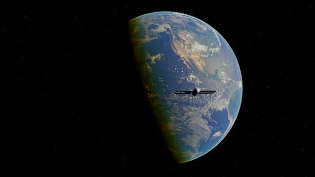
The integration of advanced technologies such as satellite imaging, drones, and artificial intelligence has expanded the capabilities of earth observation. Satellite imaging, in particular, has become a crucial tool for earth observation, providing high-resolution images of the Earth’s surface. These images can be used to monitor deforestation, track ocean currents, and predict weather patterns. The use of drones has also become increasingly popular in earth observation, as they provide a cost-effective and flexible means of collecting data.
Advancements in Satellite Technology
One of the significant advancements in earth observation is the development of high-resolution satellite imaging. Satellites such as Landsat 8 and Sentinel-2 provide images with a resolution of up to 10 meters, allowing for detailed analysis of the Earth’s surface. The use of satellite imaging has numerous applications, including land use mapping, crop monitoring, and disaster response. For instance, satellite images can be used to identify areas of deforestation, track the spread of diseases, and monitor the impact of natural disasters.
The development of synthetic aperture radar (SAR) technology has also improved the capabilities of satellite imaging. SAR technology allows for the collection of data in all weather conditions, including clouds and darkness. This has made it possible to monitor areas that were previously inaccessible, such as regions with heavy cloud cover or areas with limited sunlight. The use of SAR technology has numerous applications, including land deformation monitoring, soil moisture mapping, and sea ice tracking.
Artificial Intelligence and Machine Learning
The integration of artificial intelligence (AI) and machine learning (ML) has significantly improved the analysis of earth observation data. AI and ML algorithms can be used to automatically classify images, detect patterns, and identify trends. For instance, AI-powered algorithms can be used to classify land use patterns, detect deforestation, and identify areas of soil erosion. The use of AI and ML has also improved the accuracy of predictions, such as weather forecasting and crop yields.
The development of deep learning algorithms has also improved the analysis of earth observation data. Deep learning algorithms can be used to analyze large datasets, such as satellite images, and extract valuable insights. For instance, deep learning algorithms can be used to detect objects, such as buildings, roads, and vehicles, and track changes over time. The use of deep learning algorithms has numerous applications, including urban planning, traffic management, and environmental monitoring.
Applications of Earth Observation
The applications of earth observation are numerous and diverse. Earth observation can be used to monitor environmental changes, such as deforestation, soil erosion, and climate change. It can also be used to manage natural resources, such as water, land, and minerals. The use of earth observation has also improved disaster response, allowing for quick assessment of damage and allocation of resources.
The use of earth observation has also improved agriculture, allowing for precision farming and crop monitoring. Farmers can use satellite images to monitor crop health, detect pests and diseases, and optimize irrigation. The use of earth observation has also improved urban planning, allowing for the optimization of urban development and infrastructure management.
Conclusion
In conclusion, Eyes in the Sky: Advanced Technologies Transforming Earth Observation has revolutionized the field of earth observation. The integration of advanced technologies such as satellite imaging, drones, and artificial intelligence has expanded the capabilities of earth observation, making it more efficient, accurate, and accessible. The applications of earth observation are numerous and diverse, ranging from environmental monitoring to disaster response and agriculture. As technology continues to advance, we can expect to see even more innovative applications of earth observation, transforming the way we understand and manage our planet.


