Orbiting Innovations: Exploring the Latest in Earth-Observing Technology
The latest advancements in Earth-observing technology are transforming our understanding of the planet and its resources. From satellite imaging to remote sensing, these innovations are having a profound impact on various fields, including environmental monitoring, agriculture, and urban planning.
Orbiting Innovations: Exploring the Latest in Earth-Observing Technology
Orbiting Innovations: Exploring the Latest in Earth-Observing Technology is a rapidly evolving field that has seen significant advancements in recent years. The use of satellite imaging and remote sensing technologies has become increasingly important for monitoring the Earth’s resources, predicting weather patterns, and tracking environmental changes. In this article, we will delve into the latest innovations in Earth-observing technology and explore their applications in various fields.
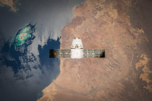
The latest Earth-observing satellites are equipped with advanced sensors and imaging technologies that enable them to capture high-resolution images of the Earth’s surface. These images can be used to monitor land use changes, track deforestation, and detect early signs of natural disasters such as wildfires and floods. For instance, the European Space Agency’s (ESA) Sentinel-2 satellite has been used to monitor crop health and yield, allowing farmers to make informed decisions about irrigation and fertilization.
Applications of Earth-Observing Technology
Earth-observing technology has a wide range of applications, from environmental monitoring to urban planning. In the field of environmental monitoring, satellite imaging is used to track changes in air and water quality, as well as to monitor the health of forests and wildlife habitats. For example, the NASA’s Landsat 8 satellite has been used to monitor the impact of climate change on glaciers and sea ice. In the field of agriculture, remote sensing is used to monitor crop health and yield, allowing farmers to optimize their irrigation and fertilization strategies.
In addition to environmental monitoring and agriculture, Earth-observing technology is also used in urban planning. Satellite imaging is used to monitor urban growth and development, as well as to track changes in land use patterns. This information can be used to inform urban planning decisions, such as the location of new infrastructure projects and the development of green spaces. For instance, the City of Los Angeles has used satellite imaging to monitor urban heat islands and develop strategies to mitigate the urban heat island effect.
Future of Earth-Observing Technology
The future of Earth-observing technology is exciting and rapidly evolving. New technologies such as synthetic aperture radar (SAR) and hyperspectral imaging are being developed, which will enable satellites to capture even higher resolution images of the Earth’s surface. Additionally, the use of artificial intelligence (AI) and machine learning (ML) algorithms is becoming increasingly important for analyzing and interpreting satellite data.
In conclusion, Orbiting Innovations: Exploring the Latest in Earth-Observing Technology is a rapidly evolving field that has the potential to transform our understanding of the Earth and its resources. From satellite imaging to remote sensing, these innovations are having a profound impact on various fields, including environmental monitoring, agriculture, and urban planning. As new technologies continue to emerge, we can expect to see even more exciting developments in the field of Earth-observing technology.


