Eyes in the Sky: Advanced Technologies Transforming Earth Observation
The latest advancements in Earth observation technologies are revolutionizing the way we monitor and understand our planet. From high-resolution satellite imaging to advanced remote sensing capabilities, these innovations are transforming various industries and improving our daily lives.
Eyes in the Sky: Advanced Technologies Transforming Earth Observation
Eyes in the Sky: Advanced Technologies Transforming Earth Observation is a revolutionary concept that has been gaining traction in recent years. The ability to observe and monitor the Earth from space has been a significant aspect of modern technology, with numerous applications in various fields such as environmental monitoring, urban planning, and disaster management. The latest advancements in Earth observation technologies are revolutionizing the way we monitor and understand our planet.
The concept of Earth observation involves the use of satellite-based sensors and other technologies to collect data about the Earth’s surface and atmosphere. This data can be used to monitor various environmental parameters such as deforestation, soil moisture, and ocean currents. The use of advanced remote sensing technologies has enabled the collection of high-resolution data, which can be used to create detailed maps and models of the Earth’s surface.
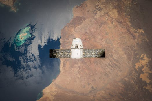
Advancements in Satellite Technology
The latest advancements in satellite technology have enabled the development of high-resolution satellite imaging capabilities. These satellites are equipped with advanced sensors that can collect data in various spectral bands, including visible, infrared, and microwave. The use of these satellites has enabled the creation of detailed maps and models of the Earth’s surface, which can be used to monitor various environmental parameters.
One of the significant advancements in satellite technology is the development of synthetic aperture radar (SAR) technology. SAR technology uses radar pulses to create high-resolution images of the Earth’s surface, even in cloudy or dark conditions. This technology has been used in various applications such as land use mapping, soil moisture monitoring, and disaster response.
Applications of Earth Observation
The applications of Earth observation are numerous and diverse. One of the significant applications is in environmental monitoring, where satellite data can be used to monitor deforestation, soil erosion, and ocean currents. The use of Earth observation data can also be used to monitor climate change, track weather patterns, and predict natural disasters.
Earth observation data can also be used in urban planning, where it can be used to create detailed maps of cities and monitor urban sprawl. The use of this data can also be used to optimize traffic flow, monitor air quality, and plan for future urban development.
In addition to these applications, Earth observation data can also be used in disaster management, where it can be used to respond to natural disasters such as hurricanes, wildfires, and floods. The use of this data can also be used to monitor the impact of disasters and plan for recovery efforts.
Conclusion
In conclusion, the latest advancements in Earth observation technologies are revolutionizing the way we monitor and understand our planet. The use of high-resolution satellite imaging, advanced remote sensing capabilities, and SAR technology has enabled the collection of detailed data about the Earth’s surface and atmosphere. The applications of Earth observation are numerous and diverse, and its use can be seen in various industries such as environmental monitoring, urban planning, and disaster management. As technology continues to evolve, we can expect to see even more innovative applications of Earth observation in the future.


