GEO Satellites: Understanding their Role in Modern Telecommunications

GEO Satellites: Understanding their Role in Modern Telecommunications
GEO satellites, or Geostationary Earth Orbit satellites, are a type of satellite that orbits the Earth at an altitude of approximately 36,000 kilometers above the equator. At this height, they remain stationary relative to a fixed point on the Earth’s surface, allowing them to provide continuous coverage of a specific region. GEO satellites have been a cornerstone of modern telecommunications, providing global coverage and facilitating international communications.
The concept of GEO satellites was first proposed by science fiction writer Arthur C. Clarke in 1945. However, it wasn’t until the 1960s that the first GEO satellite, Syncom 2, was launched. Since then, hundreds of GEO satellites have been launched, with many more planned for the future. These satellites have revolutionized the way we communicate, enabling global connectivity and providing a range of services including television broadcasting, telecommunications, and weather forecasting.
How GEO Satellites Work
GEO satellites work by transmitting and receiving signals to and from Earth stations. These signals are transmitted on a specific frequency, and the satellite amplifies and re-transmits them back to Earth, allowing them to be received by other Earth stations. The satellite’s stationary position above the equator allows it to provide continuous coverage of a specific region, making it ideal for applications such as television broadcasting and telecommunications.
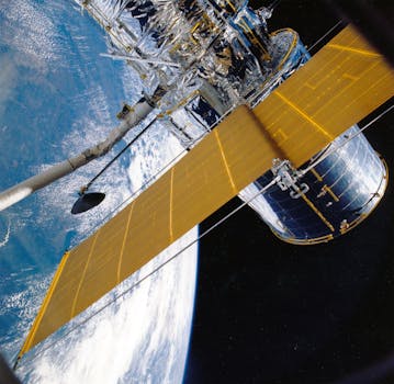
GEO satellites are typically launched into space using a rocket, and once they reach their desired orbit, they deploy their solar panels and antennae. The satellite is then positioned above a specific point on the Earth’s surface, where it remains stationary, providing continuous coverage of the region.
Applications of GEO Satellites
GEO satellites have a wide range of applications, including television broadcasting, telecommunications, weather forecasting, and navigation. They are also used for military communications, Earth observation, and scientific research. One of the most significant applications of GEO satellites is in the provision of telecommunications services, including voice, data, and internet connectivity.
GEO satellites are also used for television broadcasting, allowing channels to be transmitted globally. They are also used for weather forecasting, providing images of the Earth’s atmosphere and oceans, which are used to predict weather patterns. Additionally, GEO satellites are used for navigation, providing location information and timing signals for GPS and other navigation systems.
Future of GEO Satellites
The future of GEO satellites is exciting, with many new technologies and applications being developed. One of the most significant developments is the launch of new satellite constellations, such as the Amazon Kuiper Systems and the OneWeb constellation. These constellations will provide global coverage and enable new applications such as 5G connectivity and IoT services.
Additionally, there is a growing trend towards the use of smaller satellites, known as smallsats, which are cheaper and more efficient than traditional GEO satellites. Smallsats are being used for a range of applications, including Earth observation, telecommunications, and scientific research.
In conclusion, GEO satellites play a vital role in modern telecommunications, providing global coverage and facilitating international communications. Their applications are diverse, ranging from television broadcasting to weather forecasting, and their future is exciting, with many new technologies and applications being developed.


