High-Tech Horizons: The Evolution of Earth-Orbiting Technologies for Observation
High-Tech Horizons: The Evolution of Earth-Orbiting Technologies for Observation
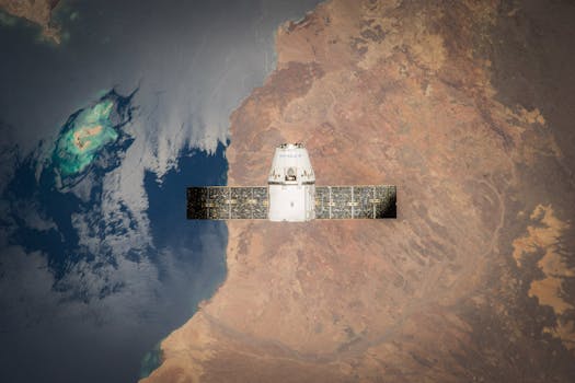
High-Tech Horizons: The Evolution of Earth-Orbiting Technologies for Observation has been a game-changer in the field of space exploration. The ability to observe our planet from space has revolutionized the way we understand and interact with our environment. From monitoring weather patterns and tracking natural disasters to studying the Earth’s climate and ecosystems, earth-orbiting technologies have enabled us to gain valuable insights into our planet’s behavior.
The history of earth-orbiting technologies dates back to the 1950s, when the first satellites were launched into space. These early satellites were simple in design and functionality, but they paved the way for the development of more complex and sophisticated technologies. One of the key milestones in the evolution of earth-orbiting technologies was the launch of the first Landsat satellite in 1972. Landsat was designed to collect data on the Earth’s natural resources, including land use, vegetation, and water resources.
The Evolution of Satellite Imaging
Over the years, satellite imaging technology has undergone significant advancements. The development of new sensors and imaging systems has enabled satellites to collect higher-resolution data and observe the Earth in greater detail. For example, the launch of the IKONOS satellite in 1999 marked a major milestone in the evolution of commercial satellite imaging. IKONOS was the first satellite to collect high-resolution images of the Earth’s surface, with a resolution of up to 1 meter.
Today, satellite imaging is a critical component of earth-orbiting technologies. Satellites like WorldView-4 and GeoEye-1 are capable of collecting images with resolutions of up to 30 centimeters. These high-resolution images have a wide range of applications, including mapping, urban planning, and disaster response. For instance, during the 2010 Haiti earthquake, satellite images played a critical role in damage assessment and response efforts.
Earth Observation and the Environment
Earth-orbiting technologies have also had a significant impact on our understanding of the environment. Satellites like NASA’s Terra and Aqua have been instrumental in studying the Earth’s climate and ecosystems. These satellites collect data on a wide range of parameters, including sea surface temperature, ocean currents, and ice cover. This data has been used to monitor climate change, track ocean health, and predict weather patterns.
In addition to environmental monitoring, earth-orbiting technologies have also been used to study the Earth’s natural resources. Satellites like the European Space Agency’s Sentinel-2 have been used to monitor land use, track deforestation, and predict crop yields. This data has been used to inform policy decisions, manage natural resources, and promote sustainable development.
Conclusion
In conclusion, High-Tech Horizons: The Evolution of Earth-Orbiting Technologies for Observation has been a remarkable journey. From the early days of satellite imaging to the current era of high-tech satellites, this technology has come a long way. As we continue to explore and understand our planet, earth-orbiting technologies will play an increasingly important role. Whether it’s monitoring the environment, tracking natural disasters, or studying the Earth’s climate, these technologies have the potential to transform our world and improve our lives.


