GEO Satellites: Understanding the Technology and Applications of Geostationary Orbit Satellites
GEO Satellites: Introduction to Geostationary Orbit Satellites
Geostationary orbit (GEO) satellites, also known as geosynchronous equatorial orbit satellites, are a type of artificial satellite that orbits the Earth at an altitude of approximately 36,000 kilometers above the equator. At this altitude, the satellite’s orbital period matches the Earth’s rotational period, allowing it to remain stationary in the sky relative to a fixed point on the Earth’s surface. This unique characteristic makes GEO satellites ideal for a variety of applications, including telecommunications, navigation, and weather forecasting.
The concept of GEO satellites was first proposed by scientist Arthur C. Clarke in 1945, and the first GEO satellite, Syncom 2, was launched in 1963. Since then, hundreds of GEO satellites have been launched, providing a wide range of services, including television broadcasting, telecommunications, and navigation.
GEO Satellites: Technology and Design
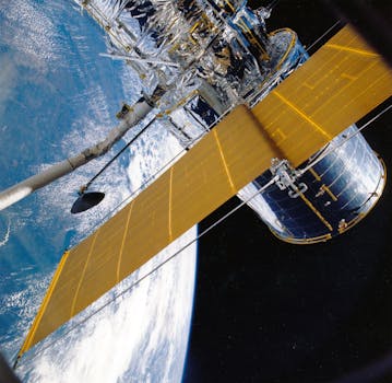
GEO satellites are designed to operate in the harsh environment of space, where they are exposed to extreme temperatures, radiation, and other forms of interference. To ensure reliable operation, GEO satellites are equipped with advanced technologies, including solar panels, batteries, and transponders. The satellite’s payload, which includes the communications equipment, is typically housed in a pressurized compartment to maintain a stable environment.
The satellite’s propulsion system is also critical, as it must be able to maintain the satellite’s position and altitude over its operational lifetime. This is typically achieved using a combination of propulsion systems, including electric propulsion and chemical propulsion. The satellite’s attitude control system, which maintains its orientation and stability, is also essential for ensuring reliable operation.
GEO Satellites: Applications and Services
GEO satellites provide a wide range of services, including telecommunications, navigation, and weather forecasting. In the telecommunications sector, GEO satellites are used to provide broadband internet access, television broadcasting, and mobile communications. They are also used to provide navigation services, including GPS and other satellite-based navigation systems.
In addition to these services, GEO satellites are also used for weather forecasting and Earth observation. They provide high-resolution images of the Earth’s surface, which are used to monitor weather patterns, track natural disasters, and study the environment. GEO satellites are also used for scientific research, including studying the Earth’s climate, oceans, and land surfaces.
GEO Satellites: Challenges and Future Developments
Despite the many benefits of GEO satellites, there are several challenges associated with their operation. One of the main challenges is the risk of collisions with other satellites or space debris, which can cause significant damage or even destroy the satellite. There is also the risk of interference from other satellites or terrestrial sources, which can disrupt the satellite’s operation.
To address these challenges, the satellite industry is developing new technologies and strategies, including advanced propulsion systems, improved shielding, and more efficient transponders. There is also a growing focus on sustainability, with many satellite operators and manufacturers committed to reducing their environmental impact and promoting responsible satellite operations.


