GEO Satellites: Introduction to Geostationary Orbit Satellites
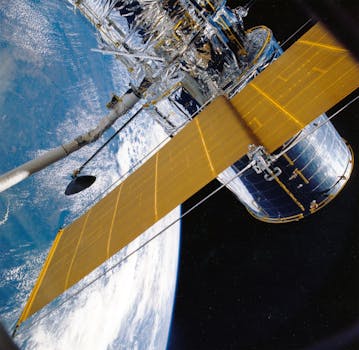
GEO satellites, or Geostationary Orbit satellites, are a type of satellite that orbits the Earth at an altitude of approximately 36,000 kilometers above the equator. At this altitude, the satellite’s orbital period matches the Earth’s rotational period, allowing it to remain stationary relative to a fixed point on the Earth’s surface. This unique characteristic makes GEO satellites an essential part of modern telecommunications, navigation, and weather forecasting.
The concept of GEO satellites was first proposed by scientist Arthur C. Clarke in 1945, and the first GEO satellite, Syncom 2, was launched in 1963. Since then, hundreds of GEO satellites have been launched, providing a wide range of services including television broadcasting, telecommunications, navigation, and weather forecasting.
How GEO Satellites Work
GEO satellites work by transmitting and receiving signals to and from Earth stations. The satellite’s antenna receives signals from the Earth station, amplifies them, and then re-transmits them back to Earth. The satellite’s transponder is responsible for amplifying and re-transmitting the signals, and it is designed to operate at specific frequency bands.
The satellite’s orbit is maintained by a combination of gravity and velocity. The satellite’s velocity is approximately 3.07 kilometers per second, which is sufficient to balance the gravitational force of the Earth. The satellite’s attitude and orbit are controlled by a combination of thrusters and reaction wheels.
Applications of GEO Satellites
GEO satellites have a wide range of applications, including:
Telecommunications: GEO satellites are used to provide telecommunications services such as telephone, internet, and television broadcasting. They are particularly useful for providing services to remote or underserved areas where terrestrial infrastructure is lacking.
Navigation: GEO satellites are used in navigation systems such as GPS and GLONASS. These systems provide location information and timing signals to receivers on the ground, allowing them to determine their precise location and velocity.
Weather Forecasting: GEO satellites are used to monitor weather patterns and provide forecasting services. They are equipped with instruments such as cameras and spectrometers that allow them to observe cloud patterns, sea surface temperatures, and other weather-related phenomena.
Challenges and Limitations of GEO Satellites
Despite their many advantages, GEO satellites also have some challenges and limitations. One of the main challenges is the high cost of launching and operating a GEO satellite. The launch cost alone can range from $50 million to $500 million, depending on the size and complexity of the satellite.
Another challenge is the limited bandwidth available on GEO satellites. The satellite’s transponder is limited to a specific frequency band, and the available bandwidth is shared among multiple users. This can lead to congestion and interference, particularly during peak usage hours.
Additionally, GEO satellites are also susceptible to space debris and other hazards. The satellite’s orbit is crowded with other satellites and debris, and there is a risk of collision or interference. Furthermore, the satellite’s electronics can be affected by radiation and other environmental factors, which can impact its performance and lifespan.


