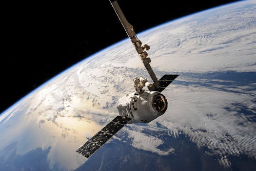
GEO Satellites: Understanding the Technology and Applications of Geostationary Orbit Satellites
GEO satellites, or geostationary orbit satellites, are a type of satellite that orbits the Earth at an altitude of approximately 36,000 kilometers above the equator. At this altitude, the satellite’s orbital period is equal to the Earth’s rotational period, allowing it to remain stationary relative to a fixed point on the Earth’s surface. This unique characteristic makes GEO satellites an essential component of modern communication and navigation systems.
The concept of GEO satellites was first proposed by science fiction writer Arthur C. Clarke in 1945, and the first GEO satellite, Syncom 2, was launched in 1963. Since then, thousands of GEO satellites have been launched, providing a wide range of services, including telecommunications, weather forecasting, navigation, and Earth observation.
How GEO Satellites Work
GEO satellites work by using a combination of propulsion systems and gravitational forces to maintain their orbit. The satellite’s propulsion system, typically a high-efficiency thruster, is used to reach the geostationary orbit and to perform any necessary maneuvers. Once in orbit, the satellite’s velocity is balanced by the gravitational force of the Earth, allowing it to remain stationary.
The satellite’s communication equipment, including transponders, antennas, and amplifiers, is used to receive and transmit signals to and from the Earth. The signals are transmitted through a process called frequency reuse, which allows multiple signals to be transmitted on the same frequency, increasing the overall capacity of the satellite.
Applications of GEO Satellites
GEO satellites have a wide range of applications, including telecommunications, weather forecasting, navigation, and Earth observation. In telecommunications, GEO satellites are used to provide services such as television broadcasting, broadband internet, and mobile phone networks. They are also used for weather forecasting, providing images and data on cloud patterns, storms, and other weather phenomena.
In navigation, GEO satellites are used to provide location information and timing signals, which are used in a variety of applications, including aviation, maritime, and land transportation. They are also used for Earth observation, providing data and images on the Earth’s surface, atmosphere, and oceans.
Challenges and Future Developments
Despite the many benefits of GEO satellites, there are several challenges associated with their use. One of the main challenges is the limited availability of orbital slots, which can lead to congestion and interference between satellites. Another challenge is the risk of collisions between satellites, which can cause significant damage and disruption to services.
To address these challenges, researchers and engineers are working on developing new technologies and techniques, such as advanced propulsion systems, more efficient communication equipment, and improved collision avoidance systems. They are also exploring new applications for GEO satellites, such as using them to provide internet connectivity to remote and underserved areas.
In addition, there are efforts to develop new types of satellites, such as megaconstellations, which are designed to provide global coverage and high-speed connectivity. These satellites are expected to play a major role in the development of future communication and navigation systems.