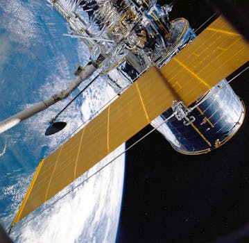
GEO Satellites: Understanding the Technology and Applications
GEO satellites, or Geostationary Earth Orbit satellites, are a type of satellite that orbits the Earth at an altitude of approximately 35,786 kilometers above the equator. At this altitude, the satellite’s orbital period matches the Earth’s rotational period, allowing it to remain stationary relative to a fixed point on the Earth’s surface. This unique characteristic makes GEO satellites ideal for a variety of applications, including telecommunications, weather forecasting, and navigation.
GEO satellites have been used for decades, with the first GEO satellite, Syncom 2, launched in 1963. Since then, the technology has improved significantly, with modern GEO satellites capable of carrying large payloads and providing high-gain antennas. The use of GEO satellites has also expanded to include a wide range of applications, such as direct-to-home television broadcasting, internet connectivity, and mobile communications.
How GEO Satellites Work
GEO satellites work by transmitting and receiving signals to and from Earth stations. The satellite receives signals from an Earth station, amplifies them, and then re-transmits them back to Earth, where they are received by another Earth station. This process allows for communication between two distant points on the Earth’s surface, making GEO satellites a crucial part of modern telecommunications. The signals transmitted by GEO satellites are typically in the C-band, Ku-band, or Ka-band frequency ranges, which offer a good balance between signal strength and interference.
The orbital position of a GEO satellite is critical to its operation. To maintain a stationary position relative to a fixed point on the Earth’s surface, a GEO satellite must be positioned at a specific altitude and longitude. The satellite’s orbital position is determined by its launch vehicle and is typically achieved through a series of orbit-raising maneuvers. Once in position, the satellite’s orbital parameters are maintained through the use of station-keeping maneuvers, which involve firing the satellite’s thrusters to maintain its position within a narrow range.
Applications of GEO Satellites
GEO satellites have a wide range of applications, including telecommunications, weather forecasting, and navigation. In the field of telecommunications, GEO satellites are used for direct-to-home television broadcasting, internet connectivity, and mobile communications. They are also used for backhaul services, which involve transmitting signals from a remote location to a central hub for distribution. In addition to telecommunications, GEO satellites are used for weather forecasting, where they provide images of cloud patterns and storm systems. They are also used for navigation, where they provide location information and timing signals.
GEO satellites are also used for a variety of other applications, including Earth observation, space exploration, and military communications. They are used to monitor the Earth’s environment, track natural disasters, and provide critical communications services during emergency response situations. In space exploration, GEO satellites are used as a relay station for deep space missions, allowing scientists to communicate with spacecraft over vast distances.
Challenges and Limitations of GEO Satellites
Despite their many applications, GEO satellites also have several challenges and limitations. One of the main challenges is the high latency of signals transmitted via GEO satellites. Because the satellite is in a high orbit, signals take a significant amount of time to travel from the Earth’s surface to the satellite and back again. This latency can be a problem for applications that require real-time communication, such as video conferencing or online gaming.
Another challenge facing GEO satellites is the limited availability of orbital slots. Because GEO satellites must be positioned at a specific altitude and longitude, there are a limited number of available slots. This has led to a shortage of available slots, particularly over populated regions. To address this challenge, satellite operators are using techniques such as frequency re-use and orbital spacing to maximize the use of available slots.
In addition to these challenges, GEO satellites also have several limitations. One of the main limitations is the high cost of launching and operating a GEO satellite. The cost of launching a satellite into GEO orbit can be tens of millions of dollars, and the cost of operating the satellite over its lifetime can be hundreds of millions of dollars. This has made it difficult for some organizations to access GEO satellite technology, particularly in developing countries.
Despite these challenges and limitations, GEO satellites remain a crucial part of modern telecommunications. They provide global coverage, high-gain antennas, and a wide range of applications. As technology continues to improve, we can expect to see even more innovative uses of GEO satellites in the future.


