GEO Satellites: Understanding the Technology and Applications of Geostationary Orbit Satellites
GEO satellites are a crucial part of modern telecommunications and earth observation, providing a wide range of services and applications. This article explores the technology and applications of GEO satellites, their advantages and disadvantages, and their impact on various industries.
GEO Satellites: Understanding the Technology and Applications of Geostationary Orbit Satellites
GEO satellites, or geostationary orbit satellites, are a type of satellite that orbits the Earth at an altitude of approximately 36,000 kilometers, remaining stationary relative to a fixed point on the equator. This unique characteristic allows GEO satellites to provide continuous coverage of a specific region, making them ideal for a wide range of applications, including telecommunications, earth observation, and weather forecasting.
GEO satellites have been in use for several decades, with the first geostationary satellite, Syncom 2, launched in 1963. Since then, the technology has advanced significantly, with modern GEO satellites featuring high-gain antennas, advanced propulsion systems, and sophisticated instrumentation. Today, there are hundreds of GEO satellites in orbit, providing a wide range of services and applications that are essential to modern life.
How GEO Satellites Work
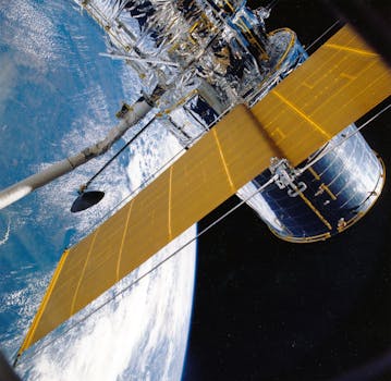
GEO satellites work by using a combination of propulsion systems and gravity to maintain their orbit. The satellite is launched into space and then propelled to its final orbit, where it uses a combination of solar panels and fuel to maintain its position. The satellite’s instrumentation and antennas are designed to collect and transmit data, which is then received by ground stations or other satellites.
One of the key advantages of GEO satellites is their ability to provide continuous coverage of a specific region. This is achieved through the use of a geostationary orbit, which allows the satellite to remain stationary relative to a fixed point on the equator. This means that the satellite can provide uninterrupted services, such as telecommunications and television broadcasting, to a specific region without the need for complex tracking systems.
Applications of GEO Satellites
GEO satellites have a wide range of applications, including telecommunications, earth observation, weather forecasting, and navigation. In the field of telecommunications, GEO satellites are used to provide television broadcasting, internet connectivity, and mobile phone services to remote and underserved areas. They are also used for earth observation, providing high-resolution images of the Earth’s surface, which are used for a variety of applications, including agriculture, forestry, and disaster response.
In addition to these applications, GEO satellites are also used for weather forecasting, providing critical data on atmospheric conditions, ocean currents, and other environmental factors. They are also used for navigation, providing location information and timing signals for a variety of applications, including aviation, maritime, and land transportation.
Advantages and Disadvantages of GEO Satellites
GEO satellites have several advantages, including their ability to provide continuous coverage of a specific region, their high-gain antennas, and their advanced instrumentation. However, they also have several disadvantages, including their high cost, their limited maneuverability, and their vulnerability to space debris and other hazards.
Despite these disadvantages, GEO satellites remain a crucial part of modern telecommunications and earth observation. They provide a wide range of services and applications that are essential to modern life, and their technology continues to advance, with new satellites featuring advanced instrumentation, propulsion systems, and communication systems.
Impact of GEO Satellites on Various Industries
GEO satellites have had a significant impact on various industries, including telecommunications, earth observation, and weather forecasting. In the field of telecommunications, GEO satellites have enabled the widespread adoption of mobile phone services, internet connectivity, and television broadcasting, particularly in remote and underserved areas.
In the field of earth observation, GEO satellites have provided high-resolution images of the Earth’s surface, which are used for a variety of applications, including agriculture, forestry, and disaster response. They have also enabled the development of new industries, such as precision agriculture and environmental monitoring.
In conclusion, GEO satellites are a crucial part of modern telecommunications and earth observation, providing a wide range of services and applications that are essential to modern life. Their technology continues to advance, with new satellites featuring advanced instrumentation, propulsion systems, and communication systems. As the demand for satellite-based services continues to grow, GEO satellites will remain a vital part of the global satellite industry.


