GEO Satellites: Unlocking the Power of Geostationary Orbit
GEO satellites, or geostationary orbit satellites, are a type of satellite that revolves around the Earth in a circular orbit at an altitude of approximately 36,000 kilometers. At this height, the satellite’s orbital period matches the Earth’s rotational period, allowing it to remain stationary relative to a fixed point on the Earth’s surface. GEO satellites are used for a variety of purposes, including telecommunications, navigation, and weather forecasting.
The concept of GEO satellites was first proposed by science fiction author Arthur C. Clarke in 1945. However, it wasn’t until the 1960s that the first GEO satellite, Syncom 2, was launched. Since then, hundreds of GEO satellites have been launched, and they have become a vital part of modern telecommunications and navigation systems.
Applications of GEO Satellites
GEO satellites have a range of applications, including telecommunications, navigation, and weather forecasting. In the field of telecommunications, GEO satellites are used to transmit data, voice, and video signals around the world. They are particularly useful for providing coverage to remote or underserved areas where traditional telecommunications infrastructure is lacking.
In addition to telecommunications, GEO satellites are also used for navigation purposes. The Global Positioning System (GPS) is a network of GEO satellites that provide location information to GPS receivers on the ground. This information is used for a variety of purposes, including navigation, surveying, and mapping.
Weather forecasting is another important application of GEO satellites. Geostationary orbit satellites are used to monitor weather patterns and provide early warnings for severe weather events such as hurricanes and typhoons. They are also used to track climate change and monitor the health of the Earth’s atmosphere.
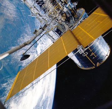
How GEO Satellites Work
GEO satellites work by using a combination of solar panels and batteries to generate power. They are equipped with transponders, which are devices that receive and retransmit signals. The signals are transmitted to and from the satellite using antennas, which are designed to operate at specific frequencies.
The satellite’s position is maintained using a combination of propulsion systems and attitude control systems. The propulsion system is used to make adjustments to the satellite’s orbit, while the attitude control system is used to maintain the satellite’s orientation and stability.
Challenges and Limitations of GEO Satellites
Despite their many advantages, GEO satellites also have some challenges and limitations. One of the main challenges is the high cost of launching and maintaining a GEO satellite. The launch process is complex and expensive, and the satellite must be designed to operate for many years in the harsh environment of space.
Another limitation of GEO satellites is the risk of interference from other satellites and terrestrial systems. As the number of satellites in geostationary orbit increases, there is a growing risk of interference and congestion. This can be mitigated using techniques such as frequency coordination and spatial separation.
Finally, GEO satellites are also limited by their altitude and orbital period. The high altitude of GEO satellites means that they have a longer delay time than satellites in lower orbits, which can make them less suitable for certain applications such as real-time communication.
Future of GEO Satellites
Despite the challenges and limitations, the future of GEO satellites looks bright. Advances in technology are making it possible to build smaller, more efficient satellites that can operate for longer periods of time. The development of new propulsion systems and attitude control systems is also improving the performance and reliability of GEO satellites.
In addition, the growing demand for telecommunications and navigation services is driving the development of new GEO satellite systems. The launch of new satellite constellations such as OneWeb and Amazon’s Kuiper Systems is expected to provide high-speed internet access to underserved areas around the world.
In conclusion, GEO satellites play a vital role in modern telecommunications, navigation, and weather forecasting. Their unique characteristics and capabilities make them an essential part of our global communications infrastructure. As technology continues to evolve, we can expect to see even more innovative applications of GEO satellites in the future.