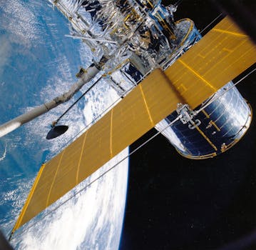
GEO Satellites: Unlocking the Power of Geostationary Orbit

GEO Satellites: Unlocking the Power of Geostationary Orbit
GEO satellites, or geostationary satellites, are a type of satellite that orbits the Earth at an altitude of approximately 36,000 kilometers, remaining stationary relative to a fixed point on the equator. This unique characteristic allows GEO satellites to provide continuous coverage of a specific region, making them ideal for a wide range of applications, including telecommunications, weather forecasting, and navigation.
At the beginning of our discussion on GEO satellites, it’s essential to understand the fundamental principles of geostationary orbit. The concept of geostationary orbit was first proposed by scientist Arthur C. Clarke in 1945, and since then, it has become a crucial part of modern satellite communications. GEO satellites are launched into a geostationary transfer orbit, which is then circularized to achieve the desired altitude and velocity.
Applications of GEO Satellites
GEO satellites have a wide range of applications, including telecommunications, broadcasting, weather forecasting, and navigation. One of the primary uses of GEO satellites is in the field of telecommunications, where they are used to provide internet connectivity, voice communications, and data transmission services. GEO satellites are also used for broadcasting purposes, such as transmitting television channels and radio signals.
In addition to telecommunications and broadcasting, GEO satellites are also used for weather forecasting and navigation. Weather satellites in geostationary orbit can provide high-resolution images of the Earth’s surface, allowing meteorologists to track weather patterns and predict storms. Navigation satellites, such as those used in the Global Positioning System (GPS), rely on GEO satellites to provide location information and timing signals.
Benefits of GEO Satellites
GEO satellites offer a number of benefits, including global coverage, high-bandwidth connectivity, and reliability. One of the primary advantages of GEO satellites is their ability to provide global coverage, allowing them to reach remote and underserved areas where traditional telecommunications infrastructure may not be available. GEO satellites also offer high-bandwidth connectivity, making them ideal for applications that require large amounts of data to be transmitted.
In addition to global coverage and high-bandwidth connectivity, GEO satellites are also highly reliable. With a typical lifespan of 15 years or more, GEO satellites can provide continuous service for extended periods, making them a critical part of modern telecommunications infrastructure. Furthermore, GEO satellites are less prone to interference and signal degradation, ensuring that communications are maintained even in the most challenging environments.
Challenges and Future Developments
Despite the many benefits of GEO satellites, there are also several challenges and limitations associated with their use. One of the primary challenges is the high cost of launching and maintaining GEO satellites, which can be prohibitively expensive for many organizations. Additionally, GEO satellites are subject to a range of technical challenges, including signal latency and interference from other satellites.
Looking to the future, there are several developments that are expected to shape the future of GEO satellites. One of the most significant trends is the increasing use of high-throughput satellites (HTS), which offer higher bandwidth and faster data transfer rates. Additionally, there is a growing interest in the use of nano-satellites and small satellites, which are smaller and less expensive than traditional GEO satellites.


