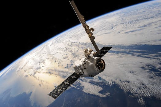
GEO Satellites: Revolutionizing Global Communications and Navigation
GEO satellites, or Geostationary Earth Orbit satellites, are a type of satellite that orbits the Earth at an altitude of approximately 36,000 kilometers, allowing them to remain stationary relative to a fixed point on the Earth’s surface. This unique characteristic enables GEO satellites to provide continuous coverage of a specific region, making them an essential part of modern telecommunications.
At the beginning of the GEO satellites era, the primary function of these satellites was to provide global communications, enabling the transmission of data, voice, and video signals across the globe. Today, GEO satellites are used for a wide range of applications, including navigation, weather forecasting, Earth observation, and more. The use of GEO satellites has revolutionized the way we communicate, navigate, and understand our planet.
How GEO Satellites Work
GEO satellites work by transmitting and receiving signals to and from Earth-based stations. The satellite’s antenna receives the signal from the Earth station and amplifies it, then re-transmits it back to Earth, where it is received by another Earth station. This process allows for the transmission of data, voice, and video signals across vast distances, enabling global communications.
The GEO satellite’s orbit is synchronized with the Earth’s rotation, allowing it to remain stationary relative to a fixed point on the Earth’s surface. This means that the satellite appears to be in a fixed position in the sky, enabling Earth stations to communicate with it continuously. The GEO satellite’s altitude and orbit also allow it to cover a wide range of frequencies, including C-band, Ku-band, and Ka-band, making it suitable for a variety of applications.
Applications of GEO Satellites
GEO satellites have a wide range of applications, including global communications, navigation, weather forecasting, and Earth observation. In the field of global communications, GEO satellites are used for broadcast services, such as television and radio, as well as for telecommunications, including voice and data transmission. They are also used for maritime communications, enabling ships to stay in touch with shore-based stations.
In the field of navigation, GEO satellites are used for GPS (Global Positioning System) and other satellite navigation systems. These systems provide location information and timing signals, enabling users to determine their exact position and velocity. GEO satellites are also used for weather forecasting, providing images of clouds, precipitation, and other weather patterns. This information is used to predict weather conditions and issue warnings for severe weather events.
Benefits and Challenges of GEO Satellites
The use of GEO satellites has several benefits, including global coverage, high bandwidth, and reliability. GEO satellites can cover a wide range of frequencies, making them suitable for a variety of applications. They also provide high bandwidth, enabling the transmission of large amounts of data. Additionally, GEO satellites are highly reliable, with some satellites operating for 15 years or more.
However, the use of GEO satellites also has some challenges. One of the main challenges is the high cost of launching and operating a GEO satellite. The launch cost alone can be hundreds of millions of dollars, and the satellite must be designed and built to withstand the harsh conditions of space. Another challenge is the risk of interference from other satellites and terrestrial systems. This can cause problems with signal quality and availability.
Despite these challenges, the use of GEO satellites continues to grow, with new applications and services being developed all the time. The future of GEO satellites looks bright, with the development of new technologies, such as high-throughput satellites and satellite constellations, enabling even more efficient and effective use of GEO satellites.


