GEO Satellites: Understanding the Technology and Applications of Geostationary Orbit Satellites
GEO Satellites: Understanding the Technology and Applications of Geostationary Orbit Satellites
GEO satellites, or geostationary orbit satellites, are a type of satellite that orbits the Earth at an altitude of approximately 36,000 kilometers, remaining stationary relative to a fixed point on the planet. This unique characteristic allows GEO satellites to provide continuous coverage of a specific region, making them ideal for a variety of applications, including telecommunications, Earth observation, and weather forecasting.
The concept of GEO satellites was first proposed by scientist Arthur C. Clarke in 1945, and the first geostationary satellite, Syncom 2, was launched in 1963. Since then, hundreds of GEO satellites have been launched, providing a wide range of services and playing a critical role in modern telecommunications and Earth observation.
How GEO Satellites Work
GEO satellites operate by transmitting and receiving signals to and from Earth stations, which are located on the ground. The signals are transmitted through a large antenna, which is typically parabolic in shape, and are received by a smaller antenna on the satellite. The satellite then amplifies the signal and re-transmits it back to Earth, allowing for communication between different points on the planet.
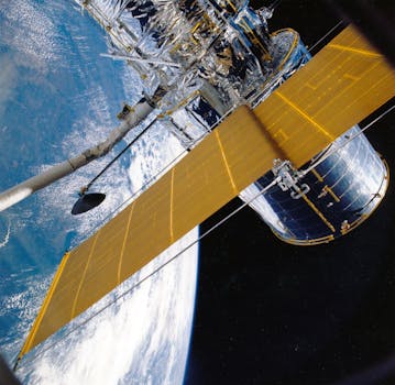
GEO satellites are typically powered by solar panels, which provide the energy needed to operate the satellite’s systems. They are also equipped with propulsion systems, which allow them to maintain their position in orbit and make any necessary adjustments.
Applications of GEO Satellites
GEO satellites have a wide range of applications, including telecommunications, Earth observation, and weather forecasting. They are used to provide television broadcasting, internet connectivity, and mobile phone services, as well as to monitor the environment, track weather patterns, and predict natural disasters.
In the field of telecommunications, GEO satellites are used to provide connectivity to remote or underserved areas, where traditional infrastructure is lacking. They are also used to provide backup services in case of emergencies or natural disasters, when traditional communication systems may be disrupted.
In Earth observation, GEO satellites are used to monitor the environment, track climate change, and predict natural disasters. They are equipped with sophisticated sensors and cameras, which provide high-resolution images of the Earth’s surface, allowing scientists to study the planet and its systems in detail.
Benefits and Challenges of GEO Satellites
GEO satellites offer a number of benefits, including global coverage, high-bandwidth connectivity, and real-time data transmission. They are also relatively low-cost compared to other types of satellites, making them an attractive option for a wide range of applications.
However, GEO satellites also face a number of challenges, including congestion in the geostationary orbit, interference from other satellites, and the risk of collisions with space debris. Additionally, the launch and operation of GEO satellites require significant investment and technical expertise, making them inaccessible to some countries and organizations.
Despite these challenges, GEO satellites continue to play a critical role in modern telecommunications and Earth observation. As technology advances and new applications emerge, the importance of GEO satellites is likely to continue to grow, providing new opportunities for communication, observation, and exploration.


