GEO Satellites: Understanding the Technology and Applications of Geostationary Orbit Satellites
GEO satellites, or geostationary orbit satellites, play a crucial role in modern telecommunications, navigation, and weather forecasting. This article delves into the technology and applications of GEO satellites, exploring their history, functionality, and impact on various industries.
GEO Satellites: Understanding the Technology and Applications of Geostationary Orbit Satellites
GEO satellites, or geostationary orbit satellites, have become an integral part of modern telecommunications, navigation, and weather forecasting. With their unique ability to remain stationary in the sky, GEO satellites have revolutionized the way we communicate, navigate, and monitor the environment. In this article, we will explore the history, technology, and applications of GEO satellites, highlighting their significance and impact on various industries.
Introduction to GEO Satellites
GEO satellites are a type of artificial satellite that orbits the Earth at an altitude of approximately 36,000 kilometers. They are placed in a geostationary orbit, which means they remain stationary in the sky, relative to a fixed point on the Earth’s surface. This is achieved by matching the satellite’s orbital period to the Earth’s rotational period, allowing it to maintain a constant position above the equator.
The concept of GEO satellites was first proposed by scientist Arthur C. Clarke in 1945. However, it wasn’t until the 1960s that the first GEO satellite, Syncom 2, was launched. Since then, hundreds of GEO satellites have been launched, providing a wide range of services, including telecommunications, navigation, weather forecasting, and Earth observation.
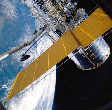
Technology and Functionality of GEO Satellites
GEO satellites are equipped with advanced technology that enables them to transmit and receive signals, as well as collect and process data. They typically consist of a payload, which includes the satellite’s instruments and antennas, and a platform, which provides the necessary power, propulsion, and communication systems.
The payload of a GEO satellite can include a variety of instruments, such as transponders, which amplify and re-transmit signals, and antennas, which receive and transmit signals. The platform, on the other hand, is responsible for maintaining the satellite’s position, velocity, and attitude, as well as providing power and communication systems.
GEO satellites use a variety of frequencies to transmit and receive signals, including C-band, Ku-band, and Ka-band. These frequencies are used for different applications, such as telecommunications, navigation, and weather forecasting. The signals transmitted by GEO satellites are received by ground stations or other satellites, which then process and distribute the data to the intended users.
Applications of GEO Satellites
GEO satellites have a wide range of applications, including telecommunications, navigation, weather forecasting, and Earth observation. In the telecommunications sector, GEO satellites are used to provide broadband internet, television broadcasting, and mobile connectivity. They are also used for navigation, providing location information and timing signals for GPS and other navigation systems.
In the field of weather forecasting, GEO satellites are used to monitor cloud patterns, precipitation, and other weather phenomena. They provide high-resolution images of the Earth’s surface, which are used to predict weather patterns and issue warnings for severe weather events. Additionally, GEO satellites are used for Earth observation, providing data on ocean currents, sea level rise, and other environmental phenomena.
Impact and Future of GEO Satellites
GEO satellites have had a significant impact on modern society, enabling global communication, navigation, and weather forecasting. They have also played a critical role in scientific research, providing data on the Earth’s climate, oceans, and land surfaces.
As technology continues to advance, we can expect to see even more innovative applications of GEO satellites. The development of new frequency bands, such as Q-band and V-band, will enable faster data transfer rates and higher resolution imaging. Additionally, the use of advanced materials and manufacturing techniques will lead to more efficient and cost-effective satellite designs.
However, the increasing number of GEO satellites in orbit also poses challenges, such as congestion, interference, and space debris. To address these issues, regulatory bodies and industry stakeholders are working together to develop new guidelines and standards for the deployment and operation of GEO satellites.


