Unlocking the Power of GEO Satellites: Revolutionizing Global Communication
GEO satellites, or Geostationary Earth Orbit satellites, are a type of satellite that orbits the Earth at an altitude of approximately 36,000 kilometers, remaining stationary relative to a fixed point on the equator. This unique characteristic allows them to provide continuous coverage of a specific region, making them ideal for various applications such as telecommunications, navigation, and weather forecasting. In this article, we will delve into the world of GEO satellites, exploring their history, functionality, and impact on global communication.
GEO satellites have been in operation for several decades, with the first geostationary satellite, Syncom 2, launched in 1963. Since then, numerous GEO satellites have been launched, providing a wide range of services including television broadcasting, telecommunications, and meteorology. The popularity of GEO satellites can be attributed to their ability to offer high-gain, directional antennas, which enable them to transmit and receive signals with greater efficiency and accuracy.
How GEO Satellites Work
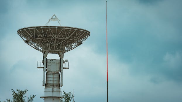
GEO satellites operate by transmitting and receiving signals to and from Earth stations, which are specialized antennas located on the ground. The signals are transmitted to the satellite, which then amplifies and re-transmits them back to Earth, allowing for communication between two distant points. This process is made possible by the satellite’s ability to maintain a stationary position relative to a fixed point on the equator, ensuring continuous coverage of a specific region.
The functionality of GEO satellites can be divided into several components, including the payload, platform, and propulsion system. The payload consists of the satellite’s communication equipment, such as transponders and antennas, which are responsible for transmitting and receiving signals. The platform provides the structural support and power for the payload, while the propulsion system enables the satellite to maintain its orbit and perform any necessary maneuvers.
Applications of GEO Satellites
GEO satellites have a wide range of applications, including telecommunications, navigation, and weather forecasting. In the field of telecommunications, GEO satellites are used to provide internet connectivity, television broadcasting, and mobile phone services to remote and underserved areas. They are also used for navigation, providing location information and timing signals for various applications, including aviation and maritime navigation.
In addition to these applications, GEO satellites are also used for weather forecasting, providing images of cloud patterns, atmospheric conditions, and other meteorological data. This information is essential for predicting weather patterns, tracking storms, and monitoring climate change. Furthermore, GEO satellites are used for earth observation, providing images of the Earth’s surface, which can be used for various applications such as land use planning, crop monitoring, and disaster response.
Future of GEO Satellites
The future of GEO satellites looks promising, with advancements in technology and the increasing demand for global connectivity. The development of new satellite constellations, such as the Amazon Kuiper System and the SpaceX Starlink constellation, is expected to provide faster and more reliable internet connectivity to remote and underserved areas. Additionally, the use of GEO satellites for 5G networks is being explored, which could enable the provision of high-speed, low-latency communication services.
However, the increasing number of satellites in orbit also poses challenges, such as space debris and radio frequency interference. To address these challenges, regulatory bodies and industry stakeholders are working together to develop guidelines and standards for the responsible use of space. Furthermore, the development of new technologies, such as satellite-based propulsion systems and advanced materials, is expected to improve the efficiency and sustainability of GEO satellites.


