GEO satellites, or geostationary orbit satellites, are a type of satellite that orbits the Earth at an altitude of approximately 36,000 kilometers, which is the exact distance required to match the Earth’s rotational period. This means that GEO satellites remain stationary in the sky, relative to a fixed point on the Earth’s surface, allowing them to provide continuous coverage of a specific region. GEO satellites have been a cornerstone of modern telecommunications and Earth observation for decades, and their applications continue to grow and expand.
The concept of GEO satellites was first proposed by scientist Arthur C. Clarke in 1945, and the first GEO satellite, Syncom 2, was launched in 1963. Since then, hundreds of GEO satellites have been launched, providing a wide range of services including telecommunications, broadcasting, weather forecasting, and Earth observation. GEO satellites have revolutionized the way we communicate, navigate, and understand our planet.
One of the primary applications of GEO satellites is in telecommunications. GEO satellites are used to provide broadband internet, telephony, and television services to remote and underserved areas. They are also used to support mobile networks, providing extended coverage and capacity. In addition, GEO satellites are used for broadcasting, allowing television channels and radio stations to reach a global audience.
Another significant application of GEO satellites is in Earth observation. GEO satellites are equipped with advanced sensors and cameras that allow them to monitor the Earth’s weather, climate, and natural resources. They are used to track hurricanes, monitor sea levels, and detect natural disasters such as earthquakes and wildfires. GEO satellites also play a critical role in environmental monitoring, allowing scientists to study the Earth’s ecosystem and track changes in the planet’s climate.
In recent years, GEO satellites have also been used for navigation and positioning. The Global Positioning System (GPS) is a network of GEO satellites that provides location information to GPS receivers on the ground. This technology has revolutionized the way we navigate, allowing us to determine our exact location and velocity with pinpoint accuracy.
Despite the many advantages of GEO satellites, there are also some challenges and limitations associated with this technology. One of the primary challenges is the high cost of launching and operating GEO satellites. The launch process is complex and expensive, and the satellites themselves require significant maintenance and upkeep. Additionally, GEO satellites are vulnerable to space debris and other hazards, which can damage or destroy the satellite.
In conclusion, GEO satellites are a vital part of modern telecommunications and Earth observation. Their applications are diverse and continue to grow, from telecommunications and broadcasting to Earth observation and navigation. While there are challenges and limitations associated with this technology, the benefits of GEO satellites far outweigh the costs. As technology continues to advance, we can expect to see even more innovative applications of GEO satellites in the future.
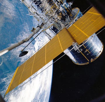
The technology behind GEO satellites is complex and fascinating. GEO satellites are designed to operate in the harsh environment of space, where temperatures can range from -270°F to 250°F, and radiation levels are high. The satellites are equipped with advanced power systems, including solar panels and batteries, which allow them to generate and store energy. They are also equipped with sophisticated communication systems, including transponders and antennas, which allow them to transmit and receive data.
The launch process for GEO satellites is also complex and requires careful planning and execution. The satellite is launched into space using a powerful rocket, which propels it to an altitude of approximately 36,000 kilometers. Once in orbit, the satellite is deployed and begins to operate, providing services to users on the ground.
In addition to their technical capabilities, GEO satellites also have significant economic and social impacts. The telecommunications industry, which relies heavily on GEO satellites, is a major driver of economic growth and development. GEO satellites also play a critical role in disaster response and recovery, providing vital communications services during emergencies.
Furthermore, GEO satellites have also been used for scientific research, allowing scientists to study the Earth’s atmosphere, oceans, and land surfaces. They have been used to monitor climate change, track ocean currents, and study the Earth’s water cycle. The data provided by GEO satellites has been instrumental in advancing our understanding of the Earth’s systems and processes.
In the future, we can expect to see even more advanced GEO satellites with improved capabilities and applications. The development of new technologies, such as high-throughput satellites and advanced propulsion systems, will enable GEO satellites to provide even faster and more reliable services. Additionally, the growing demand for telecommunications and Earth observation services will drive the launch of new GEO satellites, further expanding the capabilities and reach of this technology.


