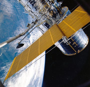
GEO Satellites: Understanding the Technology and Applications
GEO satellites, or Geostationary Orbit satellites, are a type of satellite that orbits the Earth at an altitude of approximately 36,000 kilometers, allowing them to remain stationary relative to a fixed point on the Earth’s surface. This unique characteristic makes GEO satellites ideal for a variety of applications, including telecommunications, weather forecasting, and navigation. In this article, we will delve into the technology and applications of GEO satellites, exploring their role in modern telecommunications and beyond.
How GEO Satellites Work
GEO satellites work by transmitting and receiving signals to and from Earth-based stations. The satellite’s high altitude and geostationary orbit allow it to maintain a fixed position relative to the Earth, enabling continuous communication with a specific region. The signals transmitted by the satellite are received by Earth-based stations, which then retransmit the signals to other locations, creating a global network of communication. GEO satellites use a variety of frequencies, including C-band, Ku-band, and Ka-band, to transmit signals, each with its own unique characteristics and applications.
Applications of GEO Satellites
GEO satellites have a wide range of applications, including telecommunications, broadcasting, weather forecasting, and navigation. In telecommunications, GEO satellites are used to provide internet connectivity, voice and data services, and backhaul services to remote or underserved areas. They are also used for broadcasting, allowing television channels and radio stations to reach a global audience. Additionally, GEO satellites are used for weather forecasting, providing images and data on weather patterns and storms. Navigation systems, such as GPS, also rely on GEO satellites to provide location information and timing signals.
Advantages and Challenges of GEO Satellites
GEO satellites have several advantages, including global coverage, high bandwidth, and reliability. They are also relatively low-cost compared to other types of satellites. However, GEO satellites also have some challenges, including signal latency, interference, and congestion. Signal latency occurs due to the long distance between the satellite and the Earth, resulting in a delay in signal transmission. Interference and congestion can also occur due to the large number of satellites in geostationary orbit, requiring careful management and coordination to avoid conflicts.
Future of GEO Satellites
The future of GEO satellites is promising, with advancements in technology and new applications emerging. The development of high-throughput satellites (HTS) is expected to increase the capacity and efficiency of GEO satellites, enabling more widespread adoption of satellite-based services. Additionally, the growing demand for satellite-based services, such as broadband internet and mobile connectivity, is driving investment and innovation in the GEO satellite industry. However, the industry must also address challenges such as signal latency, interference, and congestion to ensure the long-term sustainability of GEO satellites.


