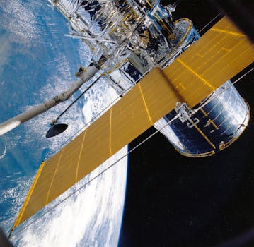
GEO Satellites: Understanding the Technology and Applications of Geostationary Orbit Satellites
GEO satellites, short for Geostationary Orbit satellites, are a type of satellite that orbits the Earth at an altitude of approximately 36,000 kilometers, remaining stationary relative to a fixed point on the equator. This unique characteristic allows GEO satellites to provide continuous coverage of a specific region, making them ideal for a wide range of applications. In this article, we will explore the technology and applications of GEO satellites, highlighting their significance and impact on our daily lives.
How GEO Satellites Work
GEO satellites are designed to operate in the geostationary orbit, which is a circular orbit that lies in the equatorial plane of the Earth. At an altitude of 36,000 kilometers, the orbital period of a satellite is equal to the rotational period of the Earth, allowing it to remain stationary relative to a fixed point on the equator. This is achieved by carefully calculating the satellite’s velocity and altitude to ensure that it maintains a constant distance from the Earth, while also matching the Earth’s rotational period.
The technology behind GEO satellites is complex and involves sophisticated systems for propulsion, navigation, and communication. These satellites are equipped with high-gain antennas, transponders, and transceivers, which enable them to receive and transmit signals to and from Earth. The signals are then amplified and re-transmitted to their destination, providing a wide range of services, including television broadcasting, telecommunications, and weather forecasting.
Applications of GEO Satellites
GEO satellites have a wide range of applications, including telecommunications, navigation, weather forecasting, and Earth observation. In the field of telecommunications, GEO satellites provide a vital link between different regions, enabling the transmission of data, voice, and video signals over long distances. They are also used for television broadcasting, allowing channels to be transmitted to a wide audience, and for mobile communications, providing coverage to remote areas where terrestrial networks are not available.
In addition to telecommunications, GEO satellites play a crucial role in navigation, providing location information and timing signals to GPS receivers on the ground. This technology is used in a wide range of applications, including aviation, maritime, and land transportation, where accurate positioning and timing are critical. GEO satellites also contribute to weather forecasting, providing imagery and data on cloud patterns, precipitation, and other meteorological conditions.
Benefits and Challenges of GEO Satellites
The benefits of GEO satellites are numerous, providing a wide range of services that are essential to modern society. They offer a high level of reliability, availability, and coverage, making them an attractive option for telecommunications, navigation, and weather forecasting. Additionally, GEO satellites can be used to provide services to remote areas, where terrestrial infrastructure is not available, making them a vital tool for bridging the digital divide.
However, GEO satellites also face several challenges, including congestion in the geostationary orbit, regulatory issues, and the risk of interference from other satellites. The increasing demand for satellite services has led to a growing number of satellites in the geostationary orbit, resulting in congestion and interference. Regulatory bodies, such as the International Telecommunication Union (ITU), play a crucial role in managing the geostationary orbit and ensuring that satellites operate in a safe and efficient manner.
Conclusion
In conclusion, GEO satellites are a vital component of modern telecommunications, navigation, and weather forecasting. Their unique characteristic of remaining stationary relative to a fixed point on the equator makes them ideal for providing continuous coverage of a specific region. As the demand for satellite services continues to grow, it is essential to address the challenges facing GEO satellites, including congestion, regulatory issues, and interference. By doing so, we can ensure that these satellites continue to provide a wide range of essential services, contributing to the development of a more connected and informed society.

