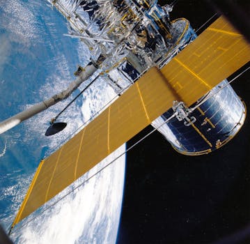
GEO Satellites: Understanding the Technology and Applications of Geostationary Orbit Satellites
GEO satellites, or geostationary orbit satellites, are a type of satellite that orbits the Earth at an altitude of approximately 35,786 kilometers (22,236 miles) above the equator. At this altitude, the satellite’s orbital period matches the Earth’s rotational period, allowing it to remain stationary relative to a fixed point on the Earth’s surface. This unique characteristic makes GEO satellites ideal for a wide range of applications, including telecommunications, navigation, and weather forecasting.
GEO satellites are often used for telecommunications, such as broadcasting television channels and providing internet connectivity to remote areas. They are also used for navigation, such as providing location information for GPS systems. Additionally, GEO satellites are used for weather forecasting, allowing meteorologists to monitor weather patterns and predict storms.
History of GEO Satellites
The concept of GEO satellites was first proposed by science fiction writer Arthur C. Clarke in 1945. However, it wasn’t until the 1960s that the first GEO satellite was launched. The first GEO satellite, called Syncom 2, was launched by NASA in 1963. Since then, hundreds of GEO satellites have been launched, with many more planned for the future.
The development of GEO satellites has been driven by advances in technology, including the development of more efficient rockets and the creation of more powerful satellite systems. Today, GEO satellites are a crucial part of modern telecommunications, navigation, and weather forecasting.
Applications of GEO Satellites
GEO satellites have a wide range of applications, including telecommunications, navigation, and weather forecasting. They are also used for Earth observation, allowing scientists to study the Earth’s climate, oceans, and land surfaces. Additionally, GEO satellites are used for space exploration, providing a platform for astronomical research and the study of the universe.
One of the most significant applications of GEO satellites is in telecommunications. GEO satellites are used to broadcast television channels, provide internet connectivity, and facilitate communication between different parts of the world. They are also used for navigation, providing location information for GPS systems and other navigation devices.
GEO satellites are also used for weather forecasting, allowing meteorologists to monitor weather patterns and predict storms. They are equipped with advanced sensors and cameras that can detect changes in the atmosphere, oceans, and land surfaces, providing valuable data for weather forecasting and climate modeling.
Challenges and Limitations of GEO Satellites
Despite the many advantages of GEO satellites, there are also several challenges and limitations to their use. One of the main challenges is the high cost of launching and maintaining GEO satellites. Additionally, GEO satellites are vulnerable to interference from other satellites and terrestrial systems, which can disrupt their operation.
Another limitation of GEO satellites is their limited bandwidth and capacity. As the demand for telecommunications and other satellite services continues to grow, GEO satellites are facing increasing pressure to provide more capacity and bandwidth. This has led to the development of new satellite technologies, such as high-throughput satellites and satellite constellations.
Finally, GEO satellites are also subject to regulatory and policy challenges. The use of GEO satellites is regulated by international law, and there are ongoing debates about issues such as spectrum allocation, satellite licensing, and the prevention of satellite collisions.
Conclusion
In conclusion, GEO satellites are a crucial part of modern telecommunications, navigation, and weather forecasting. Their unique characteristics, including their geostationary orbit and high altitude, make them ideal for a wide range of applications. However, there are also several challenges and limitations to their use, including high costs, limited bandwidth, and regulatory challenges.
As the demand for satellite services continues to grow, it is likely that GEO satellites will play an increasingly important role in the future of telecommunications, navigation, and weather forecasting. However, it is also important to address the challenges and limitations of GEO satellites, through the development of new technologies and the implementation of effective regulatory and policy frameworks.
