High-Tech Horizons: The Evolution of Earth-Orbiting Technologies for Observation
High-Tech Horizons: The Evolution of Earth-Orbiting Technologies for Observation has revolutionized the way we understand our planet and its resources. With the rapid advancement of satellite technology, we are now able to observe and monitor the Earth’s surface with unprecedented precision and accuracy. From monitoring climate change to tracking natural disasters, earth-orbiting technologies have become an essential tool for scientists, policymakers, and industries alike.
History of Earth-Orbiting Technologies
The first earth-orbiting satellite, Sputnik 1, was launched by the Soviet Union in 1957, marking the beginning of the space age. Since then, numerous satellites have been launched for various purposes, including communication, navigation, and observation. The first observational satellite, TIROS-1, was launched by NASA in 1960, providing the first television infrared observation satellite. This was followed by the launch of Landsat 1 in 1972, which was designed to collect data on the Earth’s natural resources, including land use, vegetation, and water resources.
Types of Earth-Orbiting Technologies

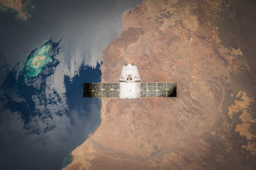
There are several types of earth-orbiting technologies, each with its unique capabilities and applications. Geostationary satellites, such as the Geostationary Operational Environmental Satellite (GOES), orbit the Earth at an altitude of approximately 36,000 kilometers, providing continuous monitoring of weather patterns and climate trends. Polar-orbiting satellites, such as the National Polar-orbiting Operational Environmental Satellite System (NPOESS), orbit the Earth at an altitude of approximately 800 kilometers, providing high-resolution data on the Earth’s surface and atmosphere.
Applications of Earth-Orbiting Technologies

Earth-orbiting technologies have a wide range of applications, including monitoring climate change, tracking natural disasters, managing natural resources, and providing early warnings for severe weather events. For example, the Moderate Resolution Imaging Spectroradiometer (MODIS) on board the Terra and Aqua satellites provides high-resolution data on ocean currents, sea surface temperature, and phytoplankton blooms. The Landsat 8 satellite provides data on land use, land cover, and crop yields, which is essential for agricultural management and food security.
Conclusion
In conclusion, High-Tech Horizons: The Evolution of Earth-Orbiting Technologies for Observation has transformed the way we understand our planet and its resources. With the rapid advancement of satellite technology, we are now able to observe and monitor the Earth’s surface with unprecedented precision and accuracy. As the demand for earth-orbiting technologies continues to grow, it is essential to invest in the development of new technologies and applications, ensuring that we can continue to monitor and manage our planet’s resources sustainably.
See more: