GEO Satellites: Understanding the Technology and Applications of Geostationary Orbit Satellites
GEO Satellites: Understanding the Technology and Applications of Geostationary Orbit Satellites
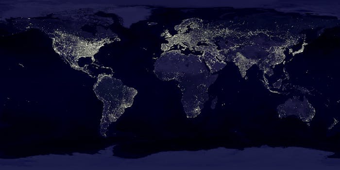
GEO satellites, or geostationary orbit satellites, are artificial satellites that orbit the Earth at an altitude of approximately 36,000 kilometers above the equator. At this altitude, the satellite’s orbital period matches the Earth’s rotational period, allowing it to remain stationary relative to a fixed point on the Earth’s surface. GEO satellites have revolutionized modern telecommunications, enabling global connectivity, and have numerous applications in earth observation, weather forecasting, and navigation.
History and Development of GEO Satellites

The concept of geostationary orbit was first proposed by science fiction writer Arthur C. Clarke in 1945. The first geostationary satellite, Syncom 2, was launched by NASA in 1963. However, it was not until the launch of Intelsat 1 in 1965 that the first commercial GEO satellite was operational. Since then, numerous GEO satellites have been launched, with applications ranging from telecommunications to earth observation and navigation.
Applications of GEO Satellites

GEO satellites have a wide range of applications, including telecommunications, earth observation, weather forecasting, and navigation. In telecommunications, GEO satellites provide global coverage, enabling voice, data, and video transmission between different regions. They are also used for television broadcasting, internet connectivity, and mobile communications. In earth observation, GEO satellites are used for monitoring climate change, tracking natural disasters, and managing natural resources. Weather forecasting is another critical application of GEO satellites, as they provide global coverage of weather patterns, enabling accurate predictions and warnings.
Challenges and Limitations of GEO Satellites

Despite the numerous benefits of GEO satellites, there are several challenges and limitations associated with their use. One of the primary challenges is orbital congestion, as the geostationary orbit is a limited resource. Additionally, GEO satellites are vulnerable to space debris, which can cause collisions and damage. The high cost of launching and maintaining GEO satellites is another significant challenge. Furthermore, the long latency of GEO satellites, which can range from 240 to 280 milliseconds, can be a limitation for certain applications, such as real-time communications.
Future of GEO Satellites

Despite the challenges and limitations, the future of GEO satellites looks promising. Advances in technology have enabled the development of more efficient and cost-effective satellites, such as all-electric propulsion systems and modular designs. The increasing demand for global connectivity and earth observation services is driving the growth of the GEO satellite market. Additionally, the development of new applications, such as satellite-based broadband and navigation, is expected to further drive the demand for GEO satellites.
See more: