GEO Satellites: Understanding the Technology and Applications of Geostationary Satellites
GEO Satellites: Understanding the Technology and Applications of Geostationary Satellites
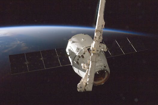
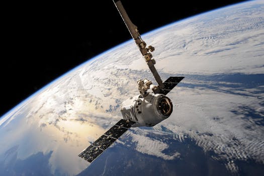
GEO satellites, or geostationary satellites, are a type of satellite that orbits the Earth at an altitude of approximately 36,000 kilometers above the equator. At this altitude, the satellite’s orbital period matches the Earth’s rotational period, allowing it to remain stationary in the sky relative to a fixed point on the Earth’s surface. This unique characteristic makes GEO satellites ideal for a wide range of applications, including telecommunications, navigation, and weather forecasting.
GEO satellites have been in use for decades, with the first geostationary satellite, Syncom 2, launched in 1963. Since then, the technology has evolved significantly, with modern GEO satellites offering higher bandwidth, greater reliability, and improved performance. Today, there are hundreds of GEO satellites in orbit, providing critical services to billions of people around the world.
How GEO Satellites Work

GEO satellites work by transmitting and receiving signals to and from Earth-based stations. The satellite’s antenna receives signals from the Earth station and re-transmits them back to Earth, allowing for communication between two distant points. The satellite’s transponder amplifies the signal and converts it to a different frequency before re-transmitting it, ensuring that the signal is strong enough to be received by the destination Earth station.
GEO satellites use a variety of frequencies, including C-band, Ku-band, and Ka-band, to transmit and receive signals. The choice of frequency depends on the application, with C-band used for telecommunications and broadcasting, Ku-band used for broadband and television broadcasting, and Ka-band used for high-speed internet and military communications.
Applications of GEO Satellites

GEO satellites have a wide range of applications, including telecommunications, navigation, weather forecasting, and Earth observation. In telecommunications, GEO satellites are used to provide broadband internet, television broadcasting, and mobile phone services to remote and underserved areas. In navigation, GEO satellites are used to provide location information and timing signals, enabling GPS and other navigation systems to function.
In weather forecasting, GEO satellites are used to monitor weather patterns and provide early warnings of severe weather events. The satellites use instruments such as radiometers and spectrometers to collect data on atmospheric conditions, which is then used to predict weather patterns and issue warnings. In Earth observation, GEO satellites are used to monitor the environment, track climate change, and provide data for disaster response and recovery.
Benefits and Challenges of GEO Satellites
GEO satellites offer several benefits, including global coverage, high bandwidth, and reliability. However, they also pose several challenges, including high launch costs, limited orbital slots, and interference from other satellites. Additionally, GEO satellites are vulnerable to space debris and radiation, which can damage the satellite’s electronics and shorten its lifespan.
Despite these challenges, GEO satellites remain a critical part of modern telecommunications, navigation, and weather forecasting systems. As technology continues to evolve, we can expect to see even more innovative applications of GEO satellites in the future.
See more: