GEO Satellites: Understanding the Technology and Applications
GEO satellites, or Geostationary Earth Orbit satellites, are a type of satellite that orbits the Earth at an altitude of approximately 36,000 kilometers. They are called geostationary because they remain stationary relative to a fixed point on the Earth’s surface, allowing them to provide continuous coverage of a specific region. GEO satellites play a crucial role in modern telecommunications, providing global coverage and enabling a wide range of applications, including television broadcasting, telecommunications, and weather forecasting.
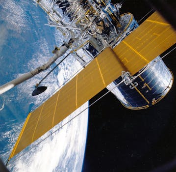
The technology behind GEO satellites is complex and involves a range of components, including the satellite itself, the launch vehicle, and the ground control system. The satellite is equipped with a range of instruments, including transponders, antennas, and solar panels, which enable it to receive and transmit signals. The launch vehicle is used to launch the satellite into orbit, and the ground control system is used to monitor and control the satellite’s operations.
Applications of GEO Satellites
GEO satellites have a wide range of applications, including television broadcasting, telecommunications, and weather forecasting. They are used to transmit television signals, providing coverage to remote and underserved areas. They are also used to provide telecommunications services, including telephone and internet connectivity. In addition, GEO satellites are used to monitor weather patterns and provide early warnings of severe weather events.
GEO satellites are also used for navigation and mapping, providing location information and timing signals. They are used in a range of industries, including aviation, maritime, and land transportation. In addition, GEO satellites are used for scientific research, including Earth observation and space weather monitoring.
Advantages and Challenges of GEO Satellites
GEO satellites have a number of advantages, including global coverage, high bandwidth, and reliability. They are able to provide continuous coverage of a specific region, making them ideal for applications that require high availability. They are also able to transmit high-bandwidth signals, making them suitable for applications that require high-speed data transfer.
However, GEO satellites also have a number of challenges, including high launch costs, limited lifespan, and orbital congestion. The cost of launching a GEO satellite is high, making it a significant investment for organizations. In addition, GEO satellites have a limited lifespan, typically ranging from 10 to 15 years, after which they must be replaced. Finally, the geostationary orbit is becoming increasingly congested, making it difficult to find available slots for new satellites.
Future of GEO Satellites
The future of GEO satellites is exciting and rapidly evolving. Advances in technology are enabling the development of smaller, more efficient satellites that are capable of providing higher bandwidth and more advanced services. In addition, the use of new materials and manufacturing techniques is reducing the cost of satellite production and launch.
In conclusion, GEO satellites play a vital role in modern telecommunications, providing global coverage and enabling a wide range of applications. While they have a number of advantages, they also have challenges that must be addressed. As technology continues to evolve, we can expect to see significant advances in the capabilities and applications of GEO satellites.


