GEO Satellites: Understanding the Technology and Applications of Geostationary Earth Orbit Satellites
GEO Satellites: Understanding the Technology and Applications of Geostationary Earth Orbit Satellites
GEO satellites, or geostationary earth orbit satellites, are a type of satellite that orbits the earth at an altitude of approximately 36,000 kilometers, remaining stationary relative to a fixed point on the earth’s surface. This unique characteristic allows GEO satellites to provide continuous coverage of a specific region, making them ideal for a wide range of applications, including telecommunications, earth observation, and weather forecasting.
The concept of GEO satellites was first proposed by scientist Arthur C. Clarke in 1945, and the first GEO satellite, Syncom 2, was launched in 1963. Since then, the technology has evolved significantly, with modern GEO satellites featuring advanced propulsion systems, high-gain antennas, and sophisticated communication equipment. Today, there are hundreds of GEO satellites in orbit, providing a vital link between different regions of the world and enabling global communications, navigation, and earth observation.
Design and Technology of GEO Satellites
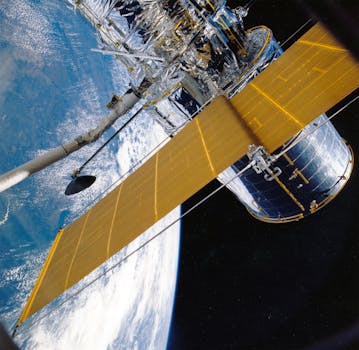
GEO satellites are designed to operate in the harsh environment of space, with extreme temperatures, radiation, and vacuum conditions. They are typically equipped with solar panels to generate power, as well as propulsion systems to maintain their orbit and perform station-keeping maneuvers. The satellite’s communication equipment, including transponders and antennas, is designed to transmit and receive signals to and from earth stations, other satellites, or directly to users.
One of the key challenges in designing GEO satellites is ensuring their stability and pointing accuracy. To maintain their position and orientation, GEO satellites use a combination of gyroscopes, star trackers, and reaction wheels. They also employ advanced materials and thermal management systems to regulate their temperature and prevent damage from extreme temperatures.
Applications of GEO Satellites
GEO satellites have a wide range of applications, including telecommunications, earth observation, weather forecasting, and navigation. In the field of telecommunications, GEO satellites provide a vital link between different regions of the world, enabling global communications, broadcasting, and internet connectivity. They are also used for earth observation, providing high-resolution images and data on the environment, climate, and natural resources.
In addition to these applications, GEO satellites play a critical role in weather forecasting, providing data on atmospheric conditions, storm tracking, and climate monitoring. They are also used for navigation, providing location information and timing signals for GPS and other navigation systems.
Future Developments and Challenges
Despite the many advances in GEO satellite technology, there are still significant challenges to be addressed. One of the major concerns is the increasing congestion in the geostationary orbit, with hundreds of satellites competing for limited space and frequency resources. There is also a growing need for more efficient and sustainable propulsion systems, as well as advanced materials and technologies to support the development of next-generation GEO satellites.
Looking to the future, there are several emerging trends and developments in GEO satellite technology, including the use of electric propulsion, advanced solar panels, and new materials and manufacturing techniques. There is also a growing interest in the development of smaller, more agile GEO satellites, which could provide more flexible and cost-effective solutions for a wide range of applications.


