GEO Satellites: Understanding the Technology and Applications
GEO satellites, or Geostationary Earth Orbit satellites, are a type of satellite that orbits the Earth at an altitude of approximately 36,000 kilometers. At this height, the satellite’s orbital period matches the Earth’s rotational period, allowing it to remain stationary in the sky. This unique characteristic makes GEO satellites ideal for a variety of applications, including telecommunications, weather forecasting, and earth observation. GEO satellites have been a crucial part of modern telecommunications and earth observation, providing a wide range of services and playing a vital role in the global economy.
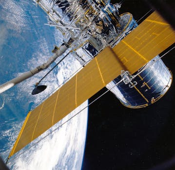
The technology behind GEO satellites is complex and involves a range of components, including the satellite itself, the launch vehicle, and the ground control system. The satellite is typically equipped with a range of instruments, including transponders, antennas, and solar panels. The launch vehicle is used to propel the satellite into orbit, while the ground control system is used to monitor and control the satellite’s operations. The development of GEO satellites has been made possible by advances in a range of technologies, including materials science, propulsion systems, and computer systems.
Applications of GEO Satellites
GEO satellites have a wide range of applications, including telecommunications, weather forecasting, and earth observation. In the field of telecommunications, GEO satellites are used to provide a range of services, including television broadcasting, internet connectivity, and mobile phone networks. They are also used to provide navigation services, such as GPS, and to support the operation of emergency services, such as search and rescue. In the field of weather forecasting, GEO satellites are used to monitor the Earth’s atmosphere and oceans, providing data that is used to predict weather patterns and track storms.
In addition to their practical applications, GEO satellites also play a crucial role in the field of earth observation. They are used to monitor the Earth’s environment, tracking changes in the climate, oceans, and land use. This data is used to support a range of activities, including conservation, sustainable development, and disaster response. The use of GEO satellites in earth observation has revolutionized our understanding of the Earth and its systems, providing insights that are essential for managing the planet’s resources and mitigating the impacts of climate change.
Benefits and Challenges of GEO Satellites
The use of GEO satellites has a number of benefits, including their ability to provide global coverage, their high bandwidth capacity, and their relatively low cost. They are also relatively easy to launch and maintain, making them a popular choice for a range of applications. However, the use of GEO satellites also presents a number of challenges, including the risk of satellite collisions, the impact of space debris, and the need for careful planning and management to ensure that the satellites are used efficiently and effectively.
Despite these challenges, the use of GEO satellites is likely to continue to grow in the coming years, driven by advances in technology and the increasing demand for satellite-based services. As the world becomes increasingly dependent on satellite technology, it is essential that we continue to develop and implement new technologies and strategies to support the safe and effective use of GEO satellites. This includes the development of new propulsion systems, the implementation of more efficient launch systems, and the creation of international agreements and regulations to govern the use of space.
Conclusion
In conclusion, GEO satellites are a crucial part of modern telecommunications and earth observation. Their unique characteristics make them ideal for a range of applications, from telecommunications and weather forecasting to earth observation and navigation. While the use of GEO satellites presents a number of challenges, the benefits they provide make them an essential part of our global infrastructure. As we look to the future, it is likely that the use of GEO satellites will continue to grow and evolve, driven by advances in technology and the increasing demand for satellite-based services.


