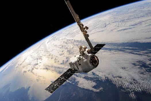
GEO Satellites: The Backbone of Global Connectivity
GEO satellites, or Geostationary Earth Orbit satellites, are a type of satellite that orbits the Earth at an altitude of approximately 36,000 kilometers, remaining stationary relative to a fixed point on the Earth’s surface. This unique characteristic allows GEO satellites to provide continuous coverage of a specific region, making them ideal for various applications such as communication, navigation, and weather forecasting.
The use of GEO satellites dates back to the 1960s, when the first geostationary satellite, Syncom 2, was launched. Since then, the technology has evolved significantly, with modern GEO satellites offering high-speed data transmission, advanced navigation systems, and improved imaging capabilities. Today, GEO satellites play a vital role in providing global connectivity, enabling communication services, and facilitating various applications that are essential for modern life.
Applications of GEO Satellites
GEO satellites have a wide range of applications, including communication, navigation, weather forecasting, and remote sensing. In the field of communication, GEO satellites are used to provide television broadcasting, telephony, and internet services to remote and underserved areas. They are also used for military communications, providing secure and reliable connectivity for military operations.
In the field of navigation, GEO satellites are used to provide location information and timing signals, enabling GPS (Global Positioning System) and other navigation systems to function accurately. Weather forecasting is another critical application of GEO satellites, as they provide high-resolution images of the Earth’s surface, allowing meteorologists to track weather patterns and predict storms.
Remote sensing is another significant application of GEO satellites, as they provide high-resolution images of the Earth’s surface, enabling scientists to monitor environmental changes, track climate patterns, and detect natural disasters. Additionally, GEO satellites are used for Earth observation, providing valuable data on the Earth’s surface, atmosphere, and oceans.
Benefits of GEO Satellites
The use of GEO satellites offers several benefits, including global coverage, high-speed data transmission, and reliability. GEO satellites provide continuous coverage of a specific region, making them ideal for applications that require real-time communication and data transmission. They also offer high-speed data transmission, enabling the transfer of large amounts of data quickly and efficiently.
Another significant benefit of GEO satellites is their reliability. They are designed to operate for extended periods, often up to 15 years or more, providing continuous service and minimizing downtime. This reliability is critical for applications such as communication, navigation, and weather forecasting, where continuous service is essential.
Challenges and Limitations of GEO Satellites
Despite the many benefits of GEO satellites, there are several challenges and limitations associated with their use. One of the primary challenges is the high cost of launching and operating GEO satellites. The cost of launching a GEO satellite can be significant, often exceeding $100 million, and the cost of operating and maintaining the satellite can be substantial.
Another challenge facing GEO satellites is the risk of interference from other satellites and terrestrial systems. As the number of satellites in orbit increases, the risk of interference grows, potentially disrupting communication and navigation services. Additionally, GEO satellites are vulnerable to space weather events, such as solar flares and coronal mass ejections, which can damage the satellite’s electronics and disrupt service.
Finally, the use of GEO satellites is subject to regulatory frameworks and international agreements, which can limit their use and deployment. The International Telecommunication Union (ITU) regulates the use of satellite frequencies and orbits, and countries must comply with these regulations to avoid interference and ensure safe operation.


