GEO Satellites: The Backbone of Global Communications – Exploring the World of Geostationary Satellites
GEO satellites play a crucial role in global communications, providing a wide range of services including television broadcasting, telecommunications, and weather forecasting. In this article, we will delve into the world of geostationary satellites, exploring their history, technology, and applications.
GEO Satellites: The Backbone of Global Communications
GEO satellites, or geostationary satellites, are a type of satellite that orbits the Earth at an altitude of approximately 36,000 kilometers, remaining stationary relative to a fixed point on the planet. This unique characteristic allows GEO satellites to provide a wide range of services, including television broadcasting, telecommunications, and weather forecasting. In this article, we will explore the history, technology, and applications of GEO satellites, highlighting their importance in modern global communications.
GEO satellites have been in use for over five decades, with the first geostationary satellite, Syncom 2, launched in 1963. Since then, the technology has evolved significantly, with advancements in materials, propulsion systems, and electronics. Today, GEO satellites are used by a variety of industries, including telecommunications, broadcasting, and navigation. The focus keyword GEO satellites is essential in understanding the role these satellites play in our daily lives.
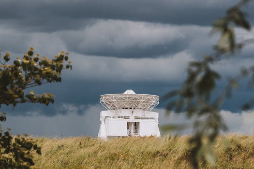
How GEO Satellites Work
GEO satellites work by orbiting the Earth at a speed that matches the planet’s rotational period, allowing them to remain stationary relative to a fixed point on the surface. This is achieved through a combination of orbital velocity and gravitational force. The satellite’s altitude and velocity are carefully calculated to ensure that it remains in a geostationary orbit, providing a stable and continuous signal to Earth-based receivers.
The technology behind GEO satellites is complex, involving advanced materials, propulsion systems, and electronics. The satellites are equipped with transponders, which receive and re-transmit signals to and from Earth-based stations. The signals are transmitted through large antennas, which are designed to maximize signal strength and minimize interference.
Applications of GEO Satellites
GEO satellites have a wide range of applications, including television broadcasting, telecommunications, and weather forecasting. They are used by television networks to broadcast channels to a global audience, providing entertainment, news, and educational programming. In the telecommunications industry, GEO satellites are used to provide mobile and fixed-line services, including voice, data, and internet connectivity.
In addition to these applications, GEO satellites are also used for navigation, providing location information and timing signals to GPS receivers. They are also used for weather forecasting, providing images and data on atmospheric conditions, ocean currents, and other environmental factors.
Future of GEO Satellites
The future of GEO satellites is exciting, with advancements in technology and new applications on the horizon. One of the most significant developments is the introduction of high-throughput satellites (HTS), which offer faster data rates and greater connectivity. HTS satellites are designed to provide broadband services, including internet access, to underserved communities and remote areas.
Another area of development is the use of GEO satellites for Earth observation, providing high-resolution images and data on environmental factors such as deforestation, climate change, and natural disasters. This information can be used to inform policy decisions, monitor environmental changes, and respond to emergencies.


