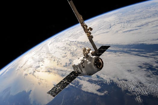
GEO Satellites: Introduction to Geostationary Orbit Satellites
GEO satellites, or geostationary orbit satellites, are a type of satellite that orbits the Earth at an altitude of approximately 36,000 kilometers above the equator. At this height, the satellite’s orbital period matches the Earth’s rotational period, allowing it to remain stationary relative to a fixed point on the Earth’s surface. This unique characteristic makes GEO satellites ideal for a variety of applications, including communication, navigation, and weather forecasting.
Geostationary orbit satellites have been in use for decades, with the first GEO satellite, Syncom 2, launched in 1963. Since then, hundreds of GEO satellites have been launched, providing a wide range of services to users around the world. In this article, we will explore the benefits and technology behind GEO satellites, as well as their applications and future developments.
GEO Satellites: Benefits and Technology
One of the primary benefits of GEO satellites is their ability to provide continuous coverage of a specific region. Because they remain stationary relative to a fixed point on the Earth’s surface, GEO satellites can provide uninterrupted service to users within their footprint. This makes them ideal for applications such as television broadcasting, telecommunications, and navigation.
GEO satellites also offer a high level of reliability and stability. Because they are in a fixed orbit, GEO satellites are less susceptible to the orbital perturbations that can affect satellites in lower orbits. This stability, combined with their high altitude, makes GEO satellites less prone to interference from other satellites or terrestrial systems.
The technology behind GEO satellites is complex and sophisticated. GEO satellites typically consist of a bus, which provides the structural and mechanical support for the satellite, and a payload, which includes the communication or navigation equipment. The bus typically includes systems for power generation, propulsion, and thermal control, while the payload includes antennas, transponders, and other equipment necessary for the satellite’s mission.
GEO Satellites: Applications and Future Developments
GEO satellites have a wide range of applications, including communication, navigation, and weather forecasting. In the field of communication, GEO satellites are used for television broadcasting, telecommunications, and internet connectivity. They are also used for navigation, providing location information and timing signals to users around the world.
In the field of weather forecasting, GEO satellites are used to monitor weather patterns and provide early warnings of severe weather events. They are also used for Earth observation, providing valuable data on the Earth’s climate, oceans, and land surfaces.
As technology continues to evolve, we can expect to see new and innovative applications for GEO satellites. One area of development is the use of GEO satellites for 5G and other next-generation wireless networks. These satellites will provide high-speed, low-latency connectivity to users around the world, enabling a wide range of new applications and services.
GEO Satellites: Conclusion
In conclusion, GEO satellites are a crucial part of modern communication and navigation systems. Their unique characteristics, including their high altitude and stable orbit, make them ideal for a wide range of applications. As technology continues to evolve, we can expect to see new and innovative applications for GEO satellites, enabling a wide range of new services and capabilities.
