GEO satellites, or Geostationary satellites, are a type of satellite that orbits the Earth at an altitude of approximately 36,000 kilometers, remaining stationary relative to a fixed point on the equator. GEO satellites have revolutionized the way we communicate and navigate, providing essential services such as television broadcasting, telecommunications, and weather forecasting. At the beginning of the 20th century, the concept of GEO satellites was first introduced by science fiction writer Arthur C. Clarke, who proposed the idea of using satellites in geostationary orbit to transmit signals across the globe.
The first GEO satellite was launched in 1963, and since then, hundreds of these satellites have been launched into orbit, providing a wide range of services including television broadcasting, telecommunications, weather forecasting, and navigation. GEO satellites are used by governments, corporations, and individuals to transmit data, voice, and video signals across the globe, enabling global communication and connectivity.
One of the most significant advantages of GEO satellites is their ability to provide continuous coverage of a specific region, making them ideal for applications such as television broadcasting and weather forecasting. They are also used for navigation purposes, providing location information and timing signals to GPS receivers on the ground. In addition, GEO satellites are used for Earth observation, monitoring the environment, and tracking climate change.
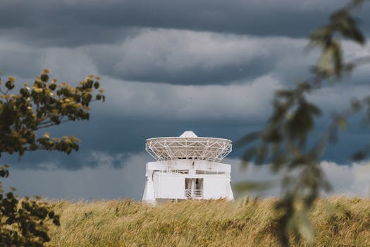
The technology used in GEO satellites is highly advanced, with sophisticated systems for power generation, propulsion, and communication. These satellites are equipped with large solar panels to generate power, and they use advanced propulsion systems to maintain their orbit and position. The communication systems on GEO satellites are also highly advanced, using large antennas and transponders to transmit and receive signals.
In the field of telecommunications, GEO satellites play a critical role, providing connectivity to remote and underserved areas. They are used to transmit data, voice, and video signals, enabling communication between people and organizations across the globe. GEO satellites are also used for disaster recovery, providing emergency communication services during natural disasters and other crises.
In the section of advantages and disadvantages, we can discuss that one of the main advantages of GEO satellites is their ability to provide continuous coverage of a specific region. However, one of the main disadvantages is the high cost of launching and maintaining these satellites. Another disadvantage is the risk of satellite failure, which can have significant consequences for the services that rely on them.
Despite these challenges, the use of GEO satellites continues to grow, with new technologies and innovations being developed to improve their performance and efficiency. The future of GEO satellites looks bright, with potential applications in areas such as 5G wireless communication, Internet of Things (IoT), and space exploration.
In conclusion, GEO satellites have revolutionized the way we communicate and navigate, providing essential services such as television broadcasting, telecommunications, and weather forecasting. As technology continues to evolve, we can expect GEO satellites to play an even more critical role in shaping our global community.
The impact of GEO satellites on society has been significant, enabling global communication and connectivity, and providing essential services such as navigation and weather forecasting. As we look to the future, it is clear that GEO satellites will continue to play a vital role in shaping our world, and it is essential that we continue to invest in and develop this technology to meet the growing demands of our global community.
Furthermore, the economic benefits of GEO satellites are substantial, with the global satellite industry generating billions of dollars in revenue each year. The industry also provides employment opportunities for thousands of people, from engineers and technicians to operators and maintenance personnel. In addition, GEO satellites have enabled the development of new industries and services, such as satellite-based navigation and remote sensing.
Finally, the environmental impact of GEO satellites is a topic of growing concern, with the increasing number of satellites in orbit raising concerns about space debris and the potential for collisions. To mitigate these risks, it is essential that we develop and implement sustainable practices for the launch and operation of GEO satellites, and that we work to reduce the amount of waste and debris in Earth’s orbit.
In terms of the technology used in GEO satellites, there are several key components that enable their operation. These include the payload, which is the instrument or instruments that the satellite is designed to carry, such as a transmitter or a camera. The platform is the main structure of the satellite, which provides the foundation for the payload and the other components. The power system generates the electricity needed to power the satellite, and the propulsion system enables the satellite to maintain its orbit and position.
The communication system is also critical, as it enables the satellite to transmit and receive signals to and from Earth. This system typically consists of a transmitter, a receiver, and an antenna, and it is used to communicate with ground stations or other satellites. The navigation system is used to determine the satellite’s position and velocity, and to maintain its orbit and trajectory.
In addition to these components, GEO satellites also have a number of subsystems that support their operation. These include the thermal control system, which regulates the satellite’s temperature, and the attitude control system, which maintains the satellite’s orientation and stability. The data handling system is used to process and store data from the payload, and the telemetry system is used to transmit data from the satellite to the ground.
Overall, the technology used in GEO satellites is highly advanced and complex, requiring sophisticated systems and components to enable their operation. However, the benefits of these satellites are substantial, and they continue to play a critical role in shaping our global community.
The process of launching a GEO satellite is also complex and challenging, requiring careful planning and execution. The launch vehicle must be capable of carrying the satellite to the correct altitude and orbit, and the satellite must be designed to withstand the stresses of launch and the harsh conditions of space.
Once the satellite is in orbit, it must be deployed and tested to ensure that it is functioning correctly. This involves extending the solar panels and antennas, and activating the payload and other systems. The satellite must also be positioned correctly in its orbit, and its systems must be adjusted to ensure that it is operating within the desired parameters.
After the satellite is launched and deployed, it must be monitored and controlled from the ground to ensure that it continues to operate correctly. This involves tracking the satellite’s position and velocity, and adjusting its systems as needed to maintain its orbit and trajectory. The satellite’s payload and other systems must also be monitored and controlled, to ensure that they are functioning correctly and providing the desired services.
In conclusion, the process of launching and operating a GEO satellite is complex and challenging, requiring careful planning and execution. However, the benefits of these satellites are substantial, and they continue to play a critical role in shaping our global community.
Finally, the future of GEO satellites looks bright, with new technologies and innovations being developed to improve their performance and efficiency. The development of new launch vehicles and satellites is expected to reduce the cost of access to space, making it more affordable for governments, corporations, and individuals to launch and operate their own satellites.
The use of GEO satellites is also expected to expand into new areas, such as 5G wireless communication and the Internet of Things (IoT). These satellites will provide the connectivity and bandwidth needed to support the growing demands of these technologies, and they will enable new applications and services that will transform our global community.
In addition, the development of new space technologies, such as reusable launch vehicles and advanced propulsion systems, is expected to enable the establishment of permanent human settlements on the Moon and Mars. GEO satellites will play a critical role in supporting these settlements, providing the communication, navigation, and remote sensing capabilities needed to sustain human life and activity in space.
In conclusion, the future of GEO satellites is exciting and promising, with new technologies and innovations being developed to improve their performance and efficiency. As we look to the future, it is clear that GEO satellites will continue to play a vital role in shaping our global community, and that they will enable new applications and services that will transform our world.


