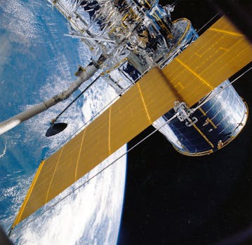
GEO Satellites: The Backbone of Global Communications – GEO Satellites
GEO satellites, or Geostationary Earth Orbit satellites, are a type of satellite that orbits the Earth at an altitude of approximately 36,000 kilometers, remaining stationary above a specific point on the equator. GEO satellites play a crucial role in global communications, providing connectivity to remote areas and enabling international communications. In this article, we will delve into the world of GEO satellites, exploring their history, technology, and importance in modern telecommunications.
GEO satellites have been in use since the 1960s, with the first GEO satellite, Syncom 2, launched in 1963. Since then, thousands of GEO satellites have been launched, providing a wide range of services, including television broadcasting, telecommunications, and weather forecasting. GEO satellites are ideal for providing global coverage, as they can see a significant portion of the Earth’s surface, allowing them to communicate with multiple countries and regions simultaneously.
How GEO Satellites Work
GEO satellites work by transmitting and receiving signals to and from Earth stations, which are located on the ground. The signals are transmitted to the satellite, which then amplifies and re-transmits them back to Earth, allowing communication between different regions. GEO satellites use a variety of frequencies, including C-band, Ku-band, and Ka-band, to transmit and receive signals. The choice of frequency depends on the specific application and the amount of data being transmitted.
GEO satellites are also equipped with transponders, which are devices that receive and re-transmit signals. Transponders are designed to operate at specific frequencies and are used to amplify and re-transmit signals back to Earth. The number of transponders on a GEO satellite can vary, depending on the specific mission and the amount of data being transmitted.
Applications of GEO Satellites
GEO satellites have a wide range of applications, including television broadcasting, telecommunications, and weather forecasting. They are also used for navigation, military communications, and Earth observation. GEO satellites are ideal for providing global coverage, as they can see a significant portion of the Earth’s surface, allowing them to communicate with multiple countries and regions simultaneously.
One of the most significant applications of GEO satellites is in the field of telecommunications. GEO satellites are used to provide connectivity to remote areas, where traditional communication infrastructure is lacking. They are also used to enable international communications, allowing people to communicate with each other across the globe. GEO satellites are also used for television broadcasting, providing entertainment and news to millions of people around the world.
Future of GEO Satellites
The future of GEO satellites is exciting, with new technologies and innovations being developed to improve their performance and capabilities. One of the most significant developments is the use of high-throughput satellites (HTS), which are designed to provide faster and more efficient communication services. HTS satellites use advanced technologies, such as spot beams and frequency re-use, to provide higher data rates and more efficient use of bandwidth.
Another significant development is the use of satellite constellations, which are groups of satellites that work together to provide global coverage. Satellite constellations are designed to provide faster and more efficient communication services, as well as improved navigation and Earth observation capabilities. They are also being used for military communications and other applications, where reliability and security are critical.
