GEO Satellites: Introduction to Geostationary Earth Orbit Satellites
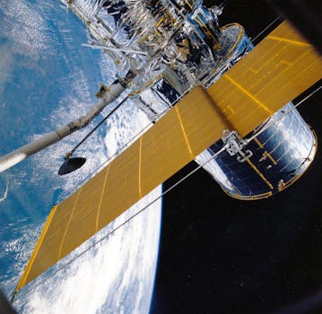
GEO satellites, or geostationary earth orbit satellites, are a type of satellite that orbits the Earth at an altitude of approximately 36,000 kilometers above the equator. At this altitude, the satellite’s orbital period matches the Earth’s rotational period, allowing it to remain stationary relative to a fixed point on the Earth’s surface. This unique characteristic makes GEO satellites ideal for a variety of applications, including telecommunications, earth observation, and weather forecasting.
History of GEO Satellites
The concept of GEO satellites was first proposed by science fiction writer Arthur C. Clarke in 1945. However, it wasn’t until the 1960s that the first GEO satellite, Syncom 2, was launched. Since then, hundreds of GEO satellites have been launched, with many more planned for the future. The development of GEO satellites has been driven by advances in technology, including improvements in rocket launch vehicles, satellite design, and materials science.
Applications of GEO Satellites
GEO satellites have a wide range of applications, including telecommunications, earth observation, and weather forecasting. In telecommunications, GEO satellites are used to transmit data, voice, and video signals across the globe. They are particularly useful for providing connectivity to remote or underserved areas, where traditional telecommunications infrastructure is lacking. In earth observation, GEO satellites are used to monitor the Earth’s surface and atmosphere, providing valuable data on climate change, natural disasters, and environmental monitoring. Weather forecasting is another important application of GEO satellites, as they can provide high-resolution images of cloud patterns, atmospheric conditions, and other weather-related phenomena.
Technological Advancements in GEO Satellites
Recent technological advancements have improved the performance and capabilities of GEO satellites. One of the most significant advancements is the development of high-throughput satellites (HTS), which can transmit large amounts of data at high speeds. HTS satellites use advanced technologies such as spot beams and frequency reuse to increase capacity and reduce interference. Another important advancement is the development of electric propulsion systems, which can extend the lifespan of GEO satellites and reduce the amount of fuel required for station-keeping maneuvers.
Challenges and Future Directions
Despite the many advantages of GEO satellites, there are also several challenges and limitations. One of the main challenges is the risk of collisions with other satellites or space debris, which can cause significant damage or even complete loss of the satellite. Another challenge is the increasing congestion of the geostationary orbit, which can lead to interference and reduced performance. To address these challenges, satellite operators and manufacturers are developing new technologies and strategies, such as advanced propulsion systems, improved collision avoidance systems, and more efficient use of the geostationary orbit. The future of GEO satellites is likely to involve the development of new applications and services, such as satellite-based internet connectivity and earth observation services.