GEO Satellites: Understanding the Importance of Geostationary Orbit
GEO satellites, or Geostationary Orbit satellites, are a type of satellite that orbits the Earth at an altitude of approximately 36,000 kilometers. GEO satellites are placed in a unique orbit that allows them to remain stationary relative to a fixed point on the Earth’s surface, making them ideal for a wide range of applications, including telecommunications, navigation, and weather forecasting.
The concept of Geostationary Orbit was first proposed by scientist Arthur C. Clarke in 1945, and the first GEO satellite, Syncom 2, was launched in 1963. Since then, numerous GEO satellites have been launched, and they have become a crucial part of modern telecommunications and navigation systems. GEO satellites are used for a variety of purposes, including television broadcasting, telecommunications, and weather forecasting.
How GEO Satellites Work
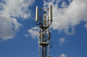
GEO satellites work by transmitting and receiving signals to and from Earth-based stations. The signals are transmitted through a large antenna on the satellite, which is directed towards the Earth. The signals are then received by a similar antenna on the ground, which is connected to a network of fiber optic cables. The signals are then routed to their final destination, which can be anywhere in the world.
The unique orbit of GEO satellites allows them to remain stationary relative to a fixed point on the Earth’s surface. This means that the satellite appears to be stationary in the sky, and the signals transmitted from the satellite can be received by a fixed antenna on the ground. This makes it ideal for applications that require a constant and reliable signal, such as television broadcasting and telecommunications.
Applications of GEO Satellites
GEO satellites have a wide range of applications, including telecommunications, navigation, and weather forecasting. They are used for television broadcasting, telecommunications, and internet connectivity. They are also used for navigation, such as GPS, and for weather forecasting, such as monitoring hurricanes and other severe weather events.
In addition to these applications, GEO satellites are also used for a variety of other purposes, including scientific research, military communications, and search and rescue operations. They are also used for monitoring the environment, such as tracking deforestation and monitoring ocean health.
Benefits of GEO Satellites
The benefits of GEO satellites are numerous. They provide a reliable and constant signal, which is ideal for applications that require a high level of connectivity. They are also relatively low-cost, compared to other types of satellites, and they have a long lifespan, typically ranging from 10 to 15 years.
In addition to these benefits, GEO satellites also have a wide range of coverage, making them ideal for applications that require global connectivity. They are also highly flexible, and can be used for a variety of purposes, including telecommunications, navigation, and weather forecasting.