GEO Satellites: Introduction to the Technology and Applications
GEO satellites, or Geostationary Earth Orbit satellites, are a type of satellite that orbits the Earth at an altitude of approximately 36,000 kilometers, remaining stationary relative to a fixed point on the equator. This unique characteristic allows GEO satellites to provide continuous coverage of a specific region, making them ideal for various applications such as telecommunications, weather forecasting, and navigation. In this article, we will delve into the world of GEO satellites, exploring their technology, applications, and significance in modern telecommunications.
GEO satellites have been in use for several decades, with the first GEO satellite, Syncom 2, launched in 1963. Since then, the technology has advanced significantly, with modern GEO satellites offering higher bandwidth, greater connectivity, and improved reliability. The primary advantage of GEO satellites is their ability to provide global coverage, facilitating international communication and connecting remote or underserved areas to the rest of the world.
Technology and Characteristics of GEO Satellites
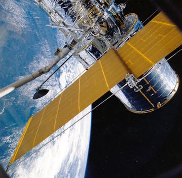
GEO satellites are designed to operate in the geostationary orbit, which is a circular orbit above the equator. To maintain this orbit, GEO satellites must have a specific velocity and altitude, ensuring that they remain stationary relative to a fixed point on the Earth’s surface. The technology used in GEO satellites includes advanced propulsion systems, solar panels, and transponders, which enable them to receive and transmit signals.
The characteristics of GEO satellites include high-gain antennas, which provide a narrow beamwidth and enable the satellite to focus its signal on a specific region. GEO satellites also have a high power output, allowing them to transmit signals over long distances. The lifespan of a GEO satellite can range from 10 to 20 years, depending on the design and mission requirements.
Applications of GEO Satellites
GEO satellites have a wide range of applications, including telecommunications, weather forecasting, navigation, and Earth observation. In telecommunications, GEO satellites are used to provide internet connectivity, mobile networks, and television broadcasting. They are also used for maritime communications, enabling ships to stay connected while at sea.
In weather forecasting, GEO satellites are used to monitor cloud patterns, track storms, and predict weather conditions. They provide high-resolution images of the Earth’s surface, allowing meteorologists to analyze and forecast weather patterns. Navigation systems, such as GPS, rely on GEO satellites to provide location information and timing signals.
Significance of GEO Satellites in Modern Telecommunications
GEO satellites play a vital role in modern telecommunications, providing global coverage and facilitating international communication. They enable the transmission of data, voice, and video signals over long distances, connecting remote or underserved areas to the rest of the world. GEO satellites are also used to provide backup connectivity during natural disasters or network outages, ensuring that critical communication services remain available.
The demand for GEO satellites is increasing, driven by the growing need for global connectivity and the expansion of telecommunications services. New technologies, such as high-throughput satellites and satellite constellations, are being developed to meet this demand and provide faster, more reliable connectivity.