GEO satellites, or Geostationary Earth Orbit satellites, are a type of satellite that orbits the Earth at an altitude of approximately 36,000 kilometers. GEO satellites are stationed above the equator, where they can maintain a fixed position relative to a point on the Earth’s surface. This allows them to provide continuous coverage of a specific region, making them ideal for a variety of applications, including telecommunications, weather forecasting, and navigation.
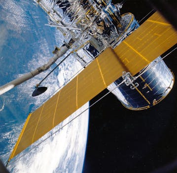
The technology behind GEO satellites is complex and involves a range of systems and components. The satellites themselves are typically equipped with a range of instruments, including transponders, antennas, and solar panels. The transponders are used to receive and re-transmit signals, while the antennas are used to transmit and receive data. The solar panels provide power to the satellite, allowing it to operate for extended periods of time.
One of the key applications of GEO satellites is in the field of telecommunications. They are used to provide a range of services, including television broadcasting, internet connectivity, and mobile phone networks. GEO satellites are particularly useful for providing coverage in remote or underserved areas, where traditional telecommunications infrastructure may not be available. They are also used to provide backup connectivity in the event of a disaster or outage, ensuring that critical communications systems remain operational.
How GEO Satellites Work
GEO satellites work by using a combination of propulsion systems and gravity to maintain their position in orbit. They are launched into space using a rocket, and then use their propulsion systems to reach their final orbit. Once in orbit, the satellites use a combination of solar panels and batteries to generate power, and a range of instruments to maintain their position and provide services.
The process of launching a GEO satellite is complex and involves a range of steps. The satellite is first launched into a temporary orbit, known as a transfer orbit, using a rocket. The satellite then uses its propulsion systems to raise its orbit to the final altitude of 36,000 kilometers. This process can take several days or even weeks to complete, depending on the specific mission requirements.
Once in orbit, the satellite is deployed and begins to provide services. The satellite’s instruments and systems are activated, and it begins to transmit and receive data. The satellite’s position is maintained using a range of systems, including propulsion systems and gravity gradient stabilization.
Applications of GEO Satellites
GEO satellites have a wide range of applications, including telecommunications, weather forecasting, navigation, and Earth observation. They are used to provide television broadcasting services, internet connectivity, and mobile phone networks. They are also used to provide backup connectivity in the event of a disaster or outage, ensuring that critical communications systems remain operational.
In addition to telecommunications, GEO satellites are used in a range of other fields. They are used to monitor weather patterns and provide early warnings of severe weather events. They are also used to provide navigation services, including GPS and other satellite-based navigation systems. Furthermore, they are used to monitor the Earth’s environment, tracking changes in the climate, oceans, and land use.
GEO satellites are also used in the field of Earth observation, where they are used to monitor the Earth’s surface and track changes in the environment. They are used to monitor deforestation, track ocean currents, and detect natural disasters such as earthquakes and hurricanes. They are also used to provide disaster relief services, including search and rescue operations and damage assessment.
Challenges and Future Developments
Despite the many benefits of GEO satellites, there are also a range of challenges associated with their use. One of the main challenges is the risk of satellite failure, which can have significant impacts on the services they provide. There is also a risk of interference from other satellites or terrestrial systems, which can disrupt the services provided by GEO satellites.
In addition to these challenges, there are also a range of future developments that are expected to shape the use of GEO satellites. One of the main trends is the increasing use of small satellites, which are smaller and less expensive than traditional GEO satellites. These satellites are being used to provide a range of services, including telecommunications and Earth observation.
Another trend is the increasing use of satellite constellations, which involve the deployment of multiple satellites in a single orbit. These constellations are being used to provide global coverage and enable a range of new applications, including satellite-based internet services. They are also being used to provide backup connectivity in the event of a disaster or outage, ensuring that critical communications systems remain operational.
Conclusion
In conclusion, GEO satellites play a crucial role in modern telecommunications, providing global coverage and enabling a wide range of applications. The technology behind GEO satellites is complex and involves a range of systems and components. They are used to provide a range of services, including telecommunications, weather forecasting, navigation, and Earth observation.
While there are challenges associated with the use of GEO satellites, there are also a range of future developments that are expected to shape their use. The increasing use of small satellites and satellite constellations is expected to provide new opportunities for the use of GEO satellites, enabling new applications and services.


