GEO Satellites: Understanding the Technology and Applications
GEO satellites, or Geostationary Earth Orbit satellites, are a type of satellite that orbits the Earth at an altitude of approximately 36,000 kilometers, remaining stationary relative to a fixed point on the equator. This unique characteristic allows GEO satellites to provide continuous coverage of a specific region, making them ideal for a variety of applications, including telecommunications, weather forecasting, and navigation.
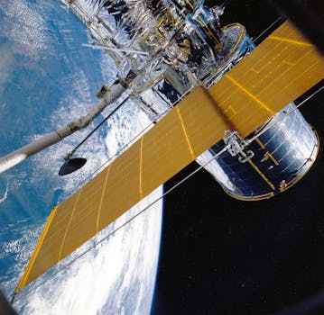
The technology behind GEO satellites is complex and fascinating. These satellites are equipped with sophisticated transponders, which receive and re-transmit signals to and from Earth. The signals are transmitted through a large antenna, which is pointing towards the Earth, and received by a smaller antenna on the ground. The transponders are powered by solar panels, which convert sunlight into electrical energy.
GEO satellites have a wide range of applications, including telecommunications, where they are used to provide internet connectivity, television broadcasting, and mobile phone services. They are also used for weather forecasting, where they provide images of cloud patterns, sea surface temperatures, and other meteorological data. In addition, GEO satellites are used for navigation, where they provide location information and timing signals for GPS and other navigation systems.
History of GEO Satellites
The concept of GEO satellites was first proposed by science fiction writer Arthur C. Clarke in 1945. The first GEO satellite, Syncom 2, was launched in 1963, but it was not until the launch of Syncom 3 in 1964 that the first commercial GEO satellite was put into operation. Since then, hundreds of GEO satellites have been launched, providing a wide range of services and applications.
One of the key benefits of GEO satellites is their ability to provide global coverage. By orbiting the Earth at an altitude of 36,000 kilometers, GEO satellites can see approximately one-third of the Earth’s surface, making them ideal for applications that require continuous coverage of a specific region. Additionally, GEO satellites are relatively low maintenance, as they do not require frequent adjustments to their orbit.
Applications of GEO Satellites
GEO satellites have a wide range of applications, including telecommunications, weather forecasting, and navigation. In telecommunications, GEO satellites are used to provide internet connectivity, television broadcasting, and mobile phone services. They are particularly useful in areas where terrestrial infrastructure is limited or non-existent, such as in remote or rural areas.
In weather forecasting, GEO satellites provide images of cloud patterns, sea surface temperatures, and other meteorological data. This information is used to predict weather patterns, track storms, and provide early warnings for severe weather events. GEO satellites are also used for navigation, where they provide location information and timing signals for GPS and other navigation systems.
GEO satellites are also used for a variety of other applications, including Earth observation, where they provide images of the Earth’s surface, and space weather monitoring, where they monitor the Sun’s activity and its impact on the Earth’s magnetic field.
Challenges and Future Developments
Despite the many benefits of GEO satellites, there are also several challenges associated with their use. One of the main challenges is the risk of collisions with other satellites or space debris, which can cause significant damage and disrupt services. Additionally, GEO satellites are vulnerable to solar flares and other space weather events, which can cause malfunctions and disrupt communications.
To address these challenges, researchers are developing new technologies and strategies for managing GEO satellites. For example, some companies are developing advanced propulsion systems that can be used to maneuver GEO satellites and avoid collisions. Others are developing new materials and designs that can protect GEO satellites from the harsh conditions of space.
In addition to these technological advancements, there are also several future developments that are expected to shape the use of GEO satellites. For example, the development of new satellite constellations, such as the OneWeb and Starlink constellations, is expected to provide global coverage and enable a wide range of new applications. Additionally, the development of new ground-based infrastructure, such as phased array antennas, is expected to improve the efficiency and capacity of GEO satellite communications.


