GEO Satellites: Understanding the Technology and Applications of Geostationary Earth Orbit Satellites
GEO Satellites: Understanding the Technology and Applications of Geostationary Earth Orbit Satellites
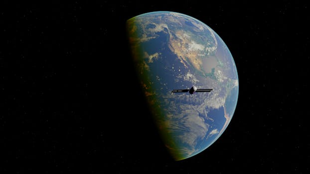
GEO satellites, or geostationary earth orbit satellites, are a type of satellite that orbits the earth at an altitude of approximately 36,000 kilometers, remaining stationary relative to a fixed point on the equator. This unique characteristic allows them to continuously observe and communicate with a specific region of the earth, making them an essential tool for various applications such as telecommunications, navigation, and weather forecasting.
The concept of GEO satellites was first proposed by science fiction writer Arthur C. Clarke in 1945, and the first GEO satellite, Syncom 2, was launched in 1963. Since then, numerous GEO satellites have been launched, with many more planned for the future. These satellites have revolutionized the way we communicate, navigate, and monitor the earth’s weather patterns.
How GEO Satellites Work
GEO satellites work by orbiting the earth at a speed that matches the earth’s rotational period, which is approximately 24 hours. This means that the satellite remains stationary relative to a fixed point on the equator, allowing it to continuously observe and communicate with a specific region of the earth. The satellite’s altitude and velocity are carefully calculated to ensure that it remains in a stable orbit, with minimal drift or deviation.
The satellite’s payload, which includes antennas, transponders, and other equipment, is designed to transmit and receive signals to and from the earth. The signals are amplified and re-transmitted back to the earth, allowing for continuous communication between the satellite and ground stations. GEO satellites can also be used for broadcasting, such as television and radio signals, as well as for navigation and weather forecasting.
Applications of GEO Satellites
GEO satellites have a wide range of applications, including telecommunications, navigation, and weather forecasting. In telecommunications, GEO satellites are used to provide internet connectivity, telephone services, and television broadcasting to remote and underserved areas. They are also used for backhaul services, which involve transmitting data from one location to another, often over long distances.
In navigation, GEO satellites are used to provide location information and timing signals, which are essential for GPS (Global Positioning System) and other navigation systems. They are also used for search and rescue operations, where they can help locate missing persons or vessels.
In weather forecasting, GEO satellites are used to monitor the earth’s weather patterns, including clouds, precipitation, and atmospheric conditions. They can provide high-resolution images of the earth’s surface, which can be used to track storms, monitor droughts, and predict weather patterns.
Future of GEO Satellites
The future of GEO satellites looks promising, with advancements in technology and new applications being developed. One of the most significant trends is the use of high-throughput satellites (HTS), which can provide faster and more reliable internet connectivity. HTS satellites use multiple spot beams to provide coverage over a wide area, increasing the overall throughput and reducing the cost per bit.
Another trend is the use of electric propulsion systems, which can extend the lifespan of a satellite and reduce the amount of fuel required for station-keeping. Electric propulsion systems use electrical energy to accelerate charged particles, such as xenon gas, to generate thrust.
In conclusion, GEO satellites are a vital component of modern telecommunications, navigation, and weather forecasting systems. Their unique characteristics and capabilities make them an essential tool for a wide range of applications, from telecommunications and navigation to weather forecasting and earth observation. As technology continues to advance, we can expect to see even more innovative applications of GEO satellites in the future.
See more: