GEO Satellites: Understanding the Technology and Applications of Geostationary Earth Orbit Satellites
GEO Satellites: Understanding the Technology and Applications of Geostationary Earth Orbit Satellites
GEO satellites, or geostationary earth orbit satellites, are a type of satellite that orbits the Earth at an altitude of approximately 36,000 kilometers. At this height, the satellite’s orbital period matches the Earth’s rotational period, allowing it to remain stationary above a fixed point on the equator. This unique characteristic makes GEO satellites an essential part of modern telecommunications, navigation, and weather forecasting.
The concept of GEO satellites was first proposed by science fiction author Arthur C. Clarke in 1945. However, it wasn’t until the 1960s that the first GEO satellite, Syncom 2, was launched. Since then, numerous GEO satellites have been launched, providing a wide range of services including television broadcasting, telecommunications, navigation, and weather forecasting.
How GEO Satellites Work
GEO satellites work by transmitting and receiving signals to and from Earth-based stations. The satellite’s antenna receives signals from the Earth station and retransmits them back to Earth, allowing for communication between two distant points. The satellite’s orbit is synchronized with the Earth’s rotation, ensuring that the satellite remains stationary above a fixed point on the equator.
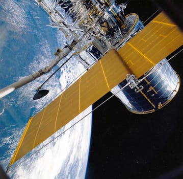
The GEO satellite’s payload consists of transponders, which are responsible for receiving and retransmitting signals. The transponders are connected to the satellite’s antenna, which is designed to receive and transmit signals in specific frequency bands. The satellite’s power source is typically provided by solar panels, which generate electricity from the sun’s energy.
Applications of GEO Satellites
GEO satellites have a wide range of applications, including television broadcasting, telecommunications, navigation, and weather forecasting. Television broadcasting is one of the most common applications of GEO satellites, with many channels being broadcast via satellite to a global audience. Telecommunications is another significant application, with GEO satellites providing internet connectivity, voice, and data services to remote areas.
Navigation is also a critical application of GEO satellites, with systems such as GPS (Global Positioning System) relying on a network of GEO satellites to provide location information. Weather forecasting is another essential application, with GEO satellites providing high-resolution images of the Earth’s weather patterns, allowing for accurate forecasting and storm tracking.
Benefits and Challenges of GEO Satellites
The benefits of GEO satellites are numerous, including global coverage, high bandwidth, and reliability. GEO satellites can provide coverage to a wide area, making them ideal for applications such as television broadcasting and telecommunications. The high bandwidth of GEO satellites also makes them suitable for applications that require high-speed data transfer, such as video conferencing and online gaming.
However, there are also challenges associated with GEO satellites, including signal latency, interference, and orbital congestion. Signal latency occurs due to the time it takes for signals to travel from the Earth station to the satellite and back, resulting in a delay of around 250 milliseconds. Interference can occur due to the large number of satellites in orbit, causing signals to overlap and result in errors. Orbital congestion is also a significant challenge, with the increasing number of satellites in orbit causing concerns about collisions and debris.
In conclusion, GEO satellites are a crucial part of modern telecommunications, navigation, and weather forecasting. Understanding the technology and applications of geostationary earth orbit satellites is essential for appreciating the importance of these satellites in our daily lives. As the demand for satellite services continues to grow, it is likely that GEO satellites will play an increasingly important role in shaping the future of space exploration and communication.


