GEO Satellites: Understanding the Technology and Applications of Geostationary Earth Orbit Satellites
GEO Satellites: Introduction to Geostationary Earth Orbit Satellites
GEO satellites, or geostationary earth orbit satellites, are a type of satellite that orbits the earth at an altitude of approximately 36,000 kilometers, remaining stationary relative to a fixed point on the earth’s surface. This unique characteristic allows GEO satellites to provide continuous coverage of a specific region, making them ideal for a wide range of applications, including telecommunications, earth observation, and weather forecasting. GEO satellites have been a cornerstone of modern telecommunications, providing services such as television broadcasting, internet connectivity, and mobile communications.
The concept of GEO satellites was first proposed by scientist Arthur C. Clarke in 1945, and the first GEO satellite, Syncom 2, was launched in 1963. Since then, thousands of GEO satellites have been launched, with many more planned for the future. GEO satellites are designed to operate for up to 15 years or more, making them a long-term investment for organizations and governments.
Design and Technology of GEO Satellites
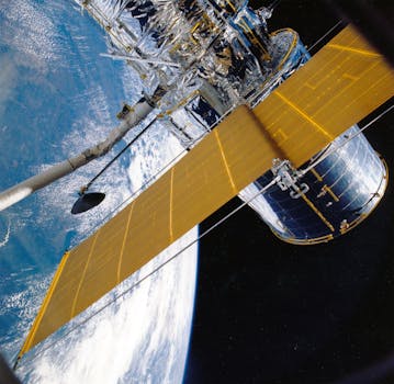
GEO satellites are designed to be highly reliable and efficient, with a range of advanced technologies and systems. They typically consist of a spacecraft bus, payload, and propulsion system. The spacecraft bus provides the structural and thermal support for the satellite, while the payload includes the communications equipment, sensors, and other instruments necessary for the satellite’s mission. The propulsion system allows the satellite to maintain its orbit and perform any necessary maneuvers.
GEO satellites use a range of frequencies, including C-band, Ku-band, and Ka-band, to transmit and receive data. They also use advanced antennas and transponders to amplify and redirect signals, allowing for high-gain and high-power communications. GEO satellites are also equipped with solar panels and batteries to provide power, as well as thermal control systems to regulate their temperature.
Applications of GEO Satellites
GEO satellites have a wide range of applications, including telecommunications, earth observation, weather forecasting, and navigation. They provide services such as television broadcasting, internet connectivity, and mobile communications, as well as data relay and telecommand services for other satellites and spacecraft. GEO satellites are also used for earth observation, providing imagery and data on the environment, climate, and natural resources.
In addition to these applications, GEO satellites are also used for weather forecasting, providing imagery and data on weather patterns and storms. They are also used for navigation, providing location and timing information for aviation, maritime, and land-based applications. GEO satellites are a critical component of modern telecommunications and earth observation, and will continue to play a vital role in the future of space exploration and development.
Conclusion
In conclusion, GEO satellites are a vital part of modern telecommunications and earth observation, providing a wide range of services and applications. Their unique characteristics, including their geostationary orbit and advanced technologies, make them ideal for a range of uses, from telecommunications and earth observation to weather forecasting and navigation. As the demand for satellite services continues to grow, the importance of GEO satellites will only continue to increase, driving innovation and development in the field of satellite technology.


